

SEATTLE — The weather system that brought snow to western Washington pushed past Seattle by mid-afternoon on Sunday.
The snow band continues to push east through Sunday evening.
Though the bulk of snowfall ended for the metro area, light flurries remain possible overnight, according to the National Weather Service.
Prior to the widespread snowfall, Whatcom and Skagit counties saw snow throughout the day Saturday, while farther south didn't see snow levels drop to sea level until sunset. Some parts of Whatcom County already had 3-6 inches of snow by Saturday evening.
Roadways were still wet on Saturday night when the temperatures dropped across central Puget Sound, so roads iced over.
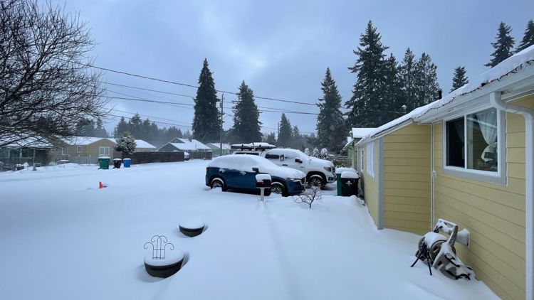
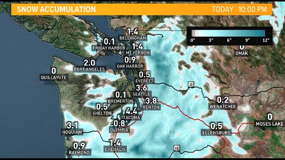
According to snowfall reports gathered by the National Weather Service, many cities in the greater Seattle area received at least 2 inches of snow in a 24-hour period by Sunday afternoon.
Now that the cold air is in place, any precipitation that comes through from now until Wednesday night will come in the form of snow. One band will move through early Sunday morning with another round expected Sunday evening.

RELATED: Western Washington forecast
And where there’s snow, there are also freezing temperatures. A weather system is expected to bring the coldest air of the season to the region this weekend and into next week, keeping snow levels near sea level.
"While we will almost certainly see snow accumulations in Seattle, our main concern at this time is the cold that will envelop the region from Sunday onward," NWS Warning Coordination Meteorologist Reid Wolcott said during a weather briefing Thursday.
High temperatures in the lowlands are expected to struggle to reach freezing, with lows in the teens by early next week. It is possible lows could drop into the single digits.
"This is a rare event," said Wolcott. "It's been many years since those of us at the weather service in Seattle have seen forecast data like this, much like the heat event that we experienced earlier this year."
Below is a forecast timeline of what to expect over the holiday weekend and beyond:
Christmas weekend
The best chances of lowland snow accumulation will be Saturday night through Sunday night as modified arctic air pushes into the Puget Sound region. The arctic air will bring dangerously cold temperatures to the region.
The NWS has issued a Winter Storm Warning for much of the Puget Sound region until 3 p.m. Sunday. Areas under the warning include Everett, Seattle, Bellevue, and Bremerton. Heavy snow is expected with additional snow accumulation of 2-5 inches, with the heaviest snow expected Sunday morning.
The rest of the region is under a Winter Weather Advisory is in effect for most lowland areas through Sunday. The NWS said snow will develop in bands, which will create variable snow accumulations, but said an additional 1-3 inches of snow is possible.
The NWS said increasing Fraser outflow will create windy conditions for the San Juan Islands and western Whatcom and Skagit counties over the next few days and into next week. A Wind Chill Advisory is in effect for those areas until 10 p.m. Saturday until 10 a.m. Monday. Wind chills could drop to between -5 to -10 over western Whatcom County Sunday, and possibly as low as -15 Sunday night and into Monday morning.
Highs on Sunday will be near or below freezing, and snow levels are expected to remain at sea level until at least Thursday and possibly through the new year.
Next week
Temperatures are expected to be in the teens across western Washington Sunday night into Monday morning, with single digits possible in Whatcom County.
High temperatures next week are expected to be in the 20s, with overnight lows in the teens as cold arctic air is expected to remain in the Puget Sound region.
Although not well defined, some disturbances will push in off the Pacific and bring light snow chances Monday through Wednesday. A larger but warmer system will arrive on Thursday that should bring a return of the dreaded rain/snow mix to the lowlands and heavy snow to the mountains.
These cold temperatures will impact vulnerable populations like the homeless and those with no access to heating. Exposed pipes may also be damaged and break from the frigid temperatures. Pets and plants should also be given extra consideration.
Temperatures could stay well below average into January.
