Washington's winter snowpack is expected to accumulate in the Cascade Range this week.
The snow level across the Cascades was down to approximately 2,000 to 2,500 feet Tuesday morning, which is below all major passes in the north and central Cascades.
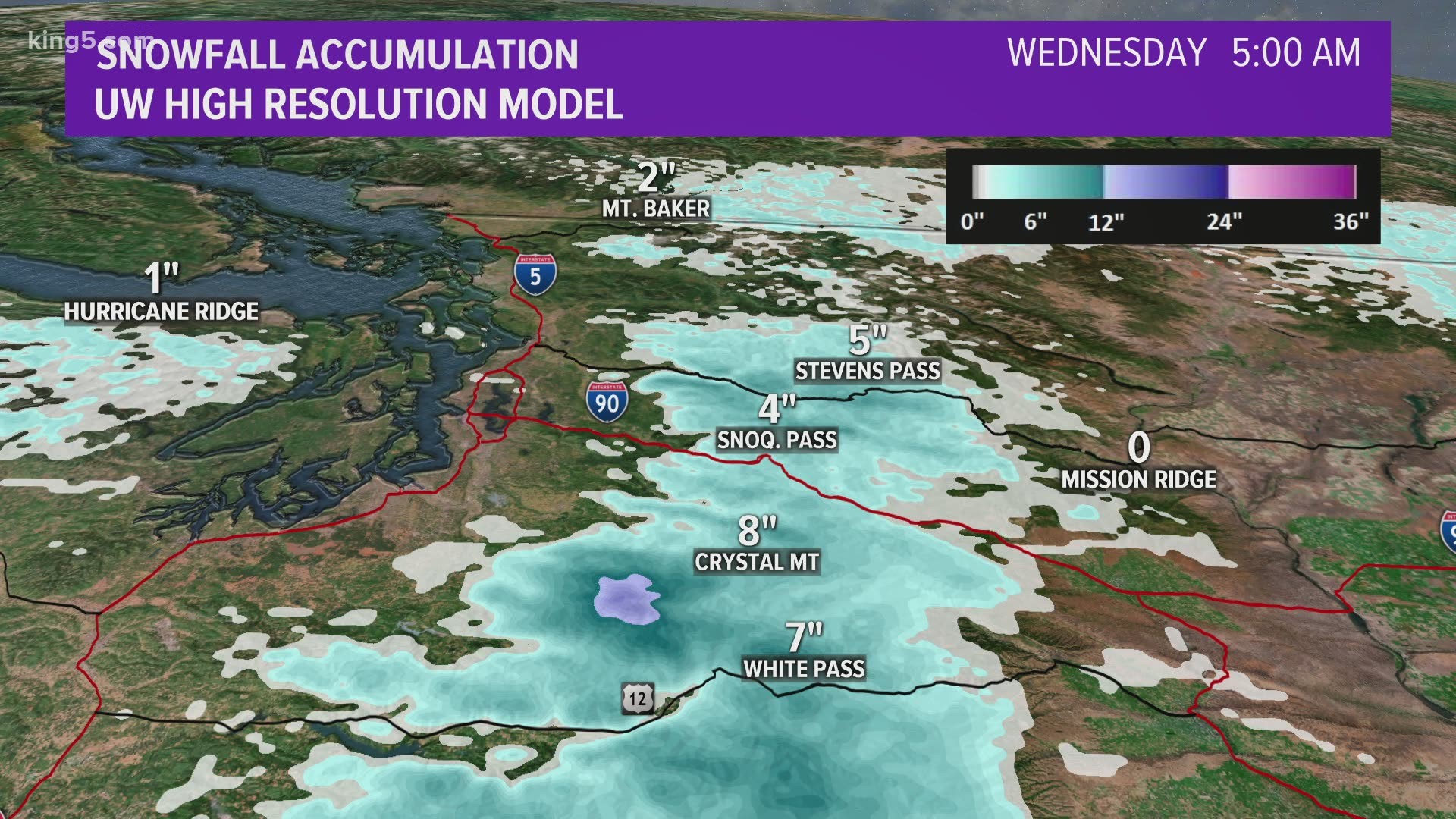
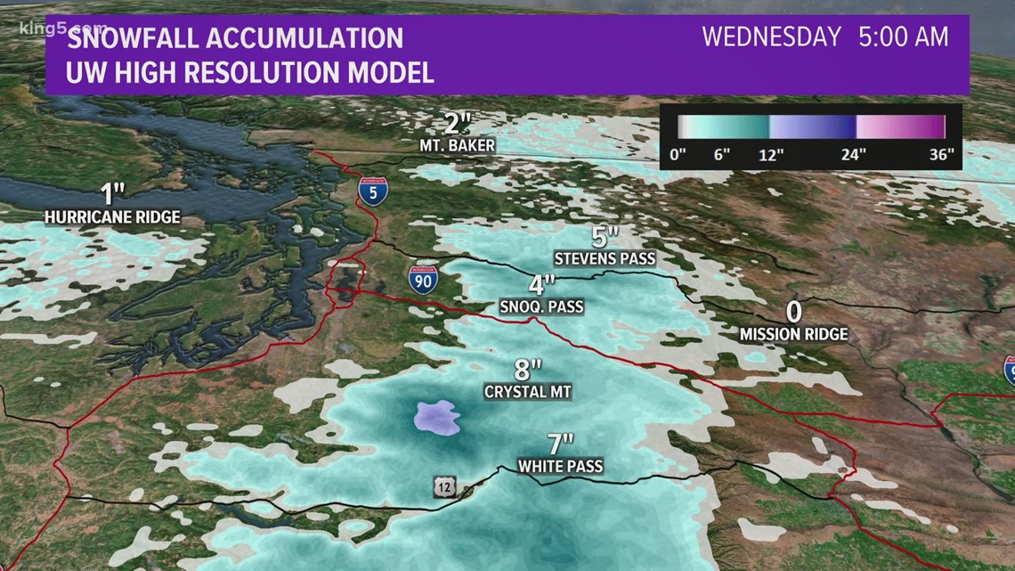
The mountains could get another 4-8 inches of new snow through Wednesday morning.

Monday's snowstorm brought up to 4 inches of snow in spots. Here's Monday's snow totals at the ski areas:
- Mount Baker: 1-2 inches
- Stevens Pass: 4 inches
- Snoqualmie Pass: 2 inches
- Crystal Mountain: 2-3 inches
- White Pass: 2 inches
There will be a break in the weather system for most of Wednesday.
The next system is expected to move in Thursday, bringing more lowland rain and mountain snow, as snow levels rise to around 3,000 feet.
Snow levels are expected to stay relatively low into next week, according to KING 5 Meteorologist Rich Marriott.
RELATED: Western Washington forecast
If you are traveling over the passes, be aware of road restrictions, including traction tire or chain requirements and limits on oversized vehicles. Check the latest conditions on the Washington State Department of Transportation's website.
While Washington is on track to experience a La Niña winter this year with above average rainfall and below average temperatures, this week's snowfall likely isn't connected to that weather phenomenon as the effects of La Niña usually don't kick in until after the first of the year.
However, the lowland rain and mountain snow isn't a big surprise at this time of year as November is on average the wettest month in the Puget Sound region. Sea-Tac Airport typically records 6.57 inches of precipitation in November. January is the second wettest month with an average of 5.57 inches of rain.