SEATTLE — After a lull in the stormy weather, another system is bringing heavy rain and more strong winds to western Washington.
The National Weather Service issued a Wind Advisory until 6 p.m. due to expected gusts of around 45 miles per hour.
The coast could see up to 2 inches of rain. The mountains could receive up to 3 inches of rain.
Saturday
Breezy winds become lighter into Saturday night before picking up up again on Sunday, according to the National Weather Service. Most gusts on Saturday ranged from 20-40 mph, with more intense wind gusts near Hoquiam and Whidbey Island.
KING 5 has activated First Alert for this weather event on Saturday. First Alert is activated when a storm could affect lives, property or travel in the Pacific Northwest region. During this event, the First Alert Weather Team will bring you the latest information to keep you and your family safe.
Southerly winds could reach up to 25 mph in the Puget Sound region with gusts of up to 45 mph from early Saturday morning through Saturday evening, according to the KING 5 Weather Team.
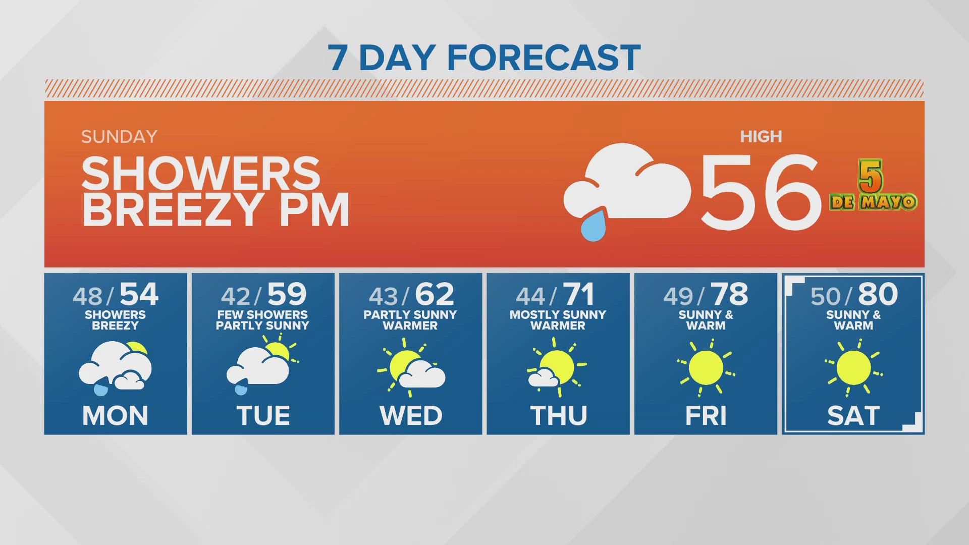
Sunday and beyond
Another system arrives Sunday with rain ahead of the front moving into western Washington. A few rain showers are possible, along with breezy conditions Sunday morning. Rain will increase in the afternoon.
Sunday's system looks to be "the weakest of the series."
Rain will continue through Wednesday with highs in the mid-50s.
Download the KING 5 app to check the interactive radar near you, as well as the latest forecast, cameras and current conditions.
Watch KING 5's top stories on YouTube