
SEATTLE — Spring begins Monday, March 20 and National Oceanic and Atmospheric Administration (NOAA) just released its Spring Outlook for the U.S.
The Spring Outlook highlights the temperature and precipitation expectations for the spring season, defined as April, May, and June, and highlights areas that could see fluctuations in the current drought conditions.
Spring temperature outlook
The winter season has been quite cool for western Washington so the last thing many people may want to see is the unusually cool conditions continue.
According to NOAA, western Washington has "equal chances" to see either above average or below average temperatures with no single direction or warmer or cooler than average being favored.
April, May, and June temperature outlook

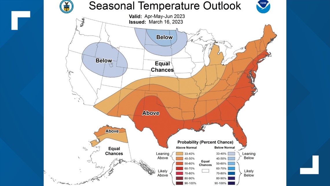
While this isn't necessarily helpful as many people want to know whether it'll be warmer or cooler than average, it does appear that the month of April will favor temperatures below average with above-average temperatures favored into May and June.
The below-average temperatures for April are shown in NOAA's April temperature outlook.
April temperature outlook

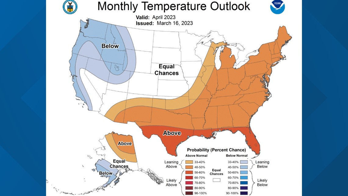
To give a snapshot of where temperatures typically stack up for the month of April, Seattle's average high temperature is 57 at the beginning of April and increases to 63 by the end of the month.
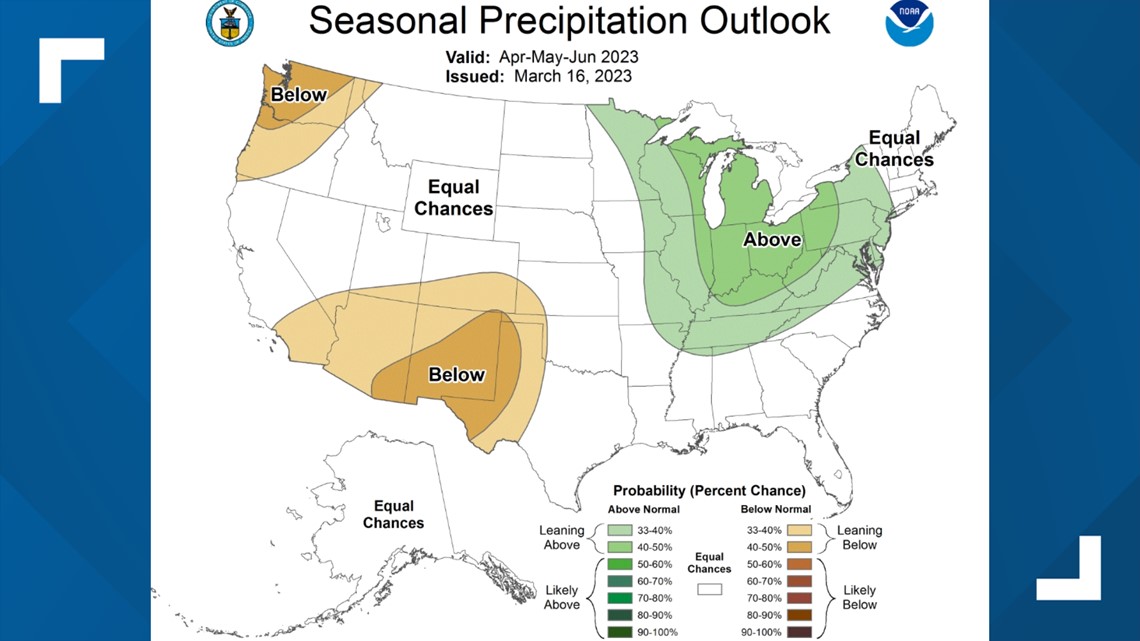
Spring precipitation outlook
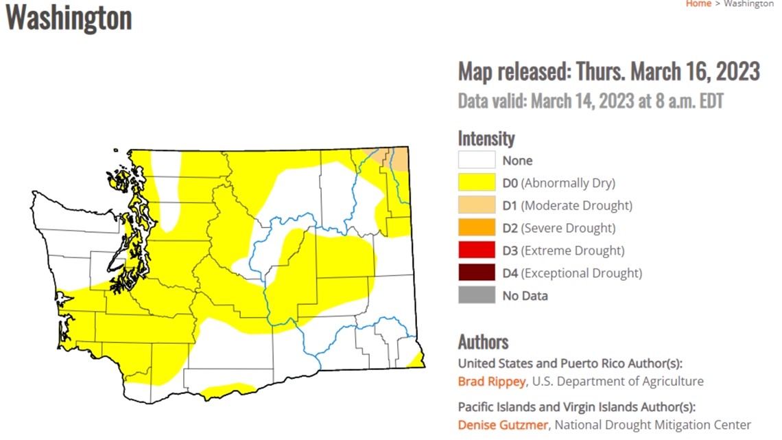
While temperatures have run below average this winter, precipitation, especially lowland rain, is running below what we would normally expect in western Washington.
Because of the below-average precipitation, coming off such a dry summer and fall, parts of the area are abnormally dry according to the latest drought monitor. The driest areas are around Puget Sound and in the central and northern Washington Cascades.
Latest drought monitor

And unfortunately, there's no strong signal of above-average precipitation for western Washington.
In fact, the spring outlook favors below-average precipitation for the area in an already increased dry period as the monthly precipitation averages decrease from 3.18 inches in April to 1.45 inches by June for Seattle.
April, May, and June precipitation outlook

The favored odds to see below-average precipitation during spring are concerning given the already dry conditions paired with the increased vegetation from last spring and early summer's wet period.
NOAA's drought outlook suggests drought conditions will develop in the Washington Cascades and the surrounding foothills.
Drought outlook


The latest runs of the long-range and seasonal models tend to agree with NOAA's spring outlook indicating a growing dry and mild to warm spring.
The current state of the snow
Fortunately, despite the drier-than-normal conditions for the lowlands of western Washington, the latest SNOTEL report, which is measured by a sophisticated network of weather stations in the Washington mountains, shows the snowpack is doing okay and not too far off from average in either direction.
This is important because this quantitative report gives a good idea of how much water will run off into the local waterways as the snow melts and the demand for water goes up as temperatures warm.
Current SNOTEL report

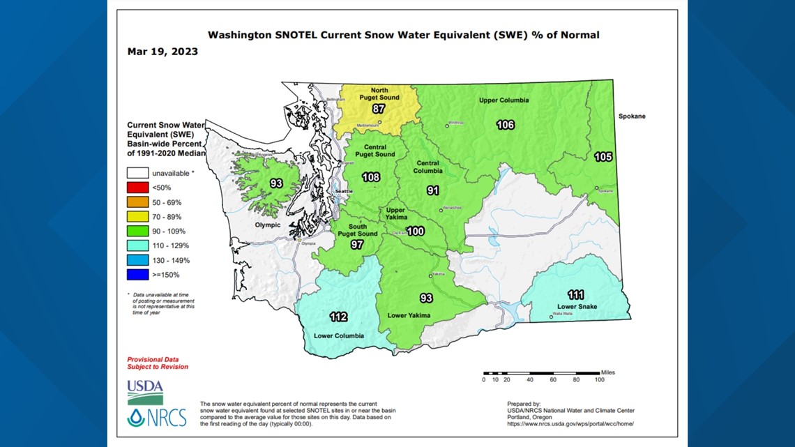
So the solid snowpack will help us as we dry out and warm up over the coming weeks and months.
As always, seasonal forecasting is an inexact science and big fluctuations in temperatures and precipitation can occur so it's important to keep checking back for updates over the coming weeks and months.