
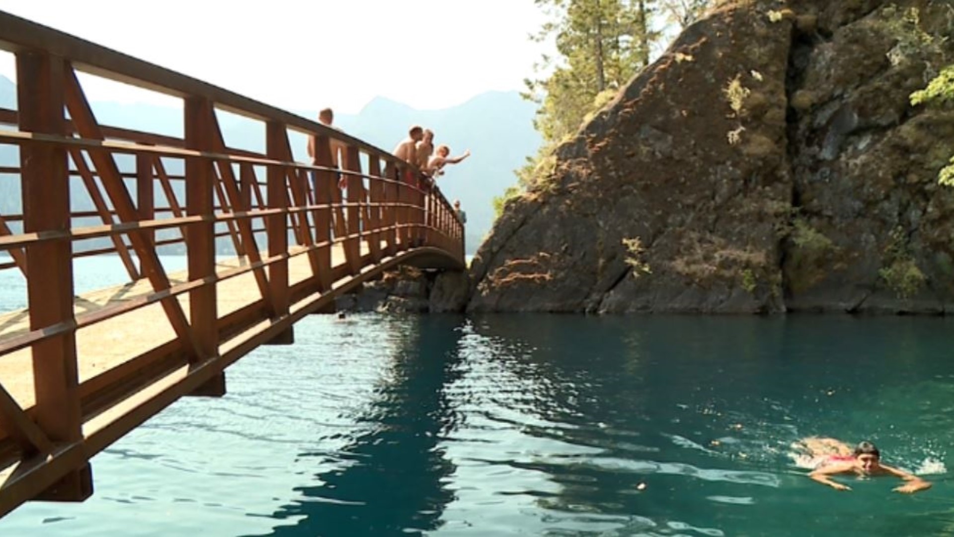
WASHINGTON — One thing everyone knows about the Pacific Northwest… we love to hike.
But with so many mountain ranges and peaks in Washington state, it may be difficult to determine what breathtaking view you are looking at. We spoke to William Gallin, a carbon sequestration geologist with the Washington State Department of Natural Resources, to help us identify the most prominent features in Washington’s skyline.
North Cascades
The Cascades stretch from Canada down to Northern California, covering over 700 miles. The Cascades cover more area and are taller than other ranges in the state. They are marked by their rough and rugged terrain.
The Washington Cascades are split into the North Cascades and the South Cascades. They were formed by tectonic forces, energy that moves the Earth’s crust, slamming onto North America. The North Cascades are situated north of I-90. Here you can see the highest nonvolcano peaks in the state.
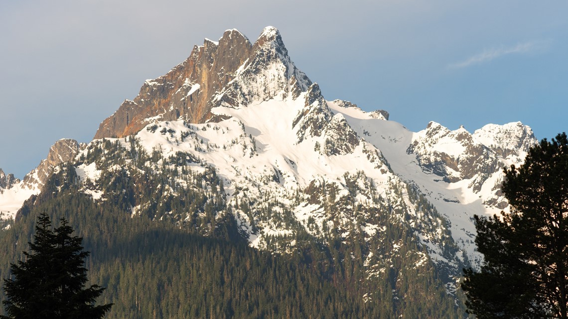
If you head north toward Everett on Interstate 5 you may come across some identifiable peaks. Three Fingers and Whitehorse Mountain are distinct for their sharp, triangular peaks. These two mountains are usually covered in snow and sit east of Arlington. Whitehorse Mountain can also be seen near Darrington on the south side of State Route 530.

Mount Pilchuck can also be seen while traveling I-5. Its peaks are not as high or as sharp as Three Fingers and Whitehorse Mountain.
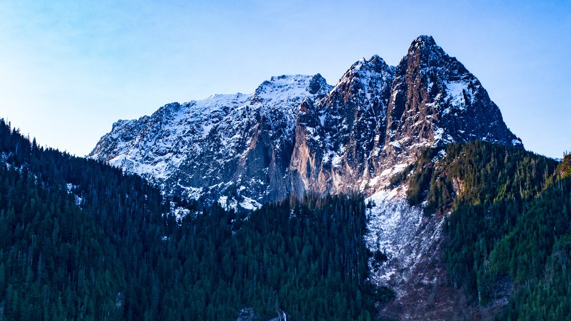
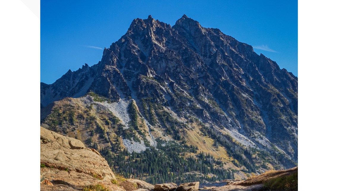
Going east on US 2, you can see Mount Index and Baring Mountain. Both of these peaks are incredibly steep, being defined by their glacier formations. Mount Index rests on the south side of US 2 near the town of, you guessed it, Index. Baring Mountain can be seen across US 2 on the road’s north side.

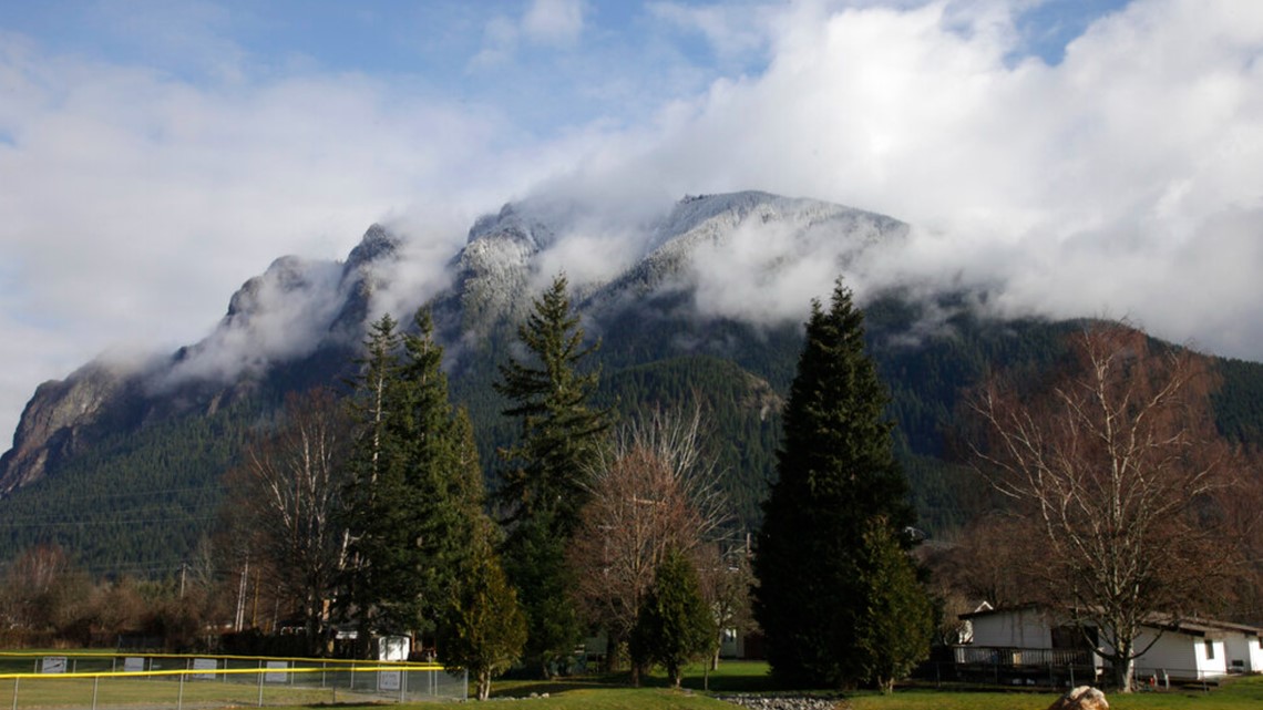
If you go east on Interstate 90, you will find Mount Si and Mailbox Peak. Situated in the Snoqualmie River Valley, you can see the large peaks on I-90’s north side near North Bend.

The highest nonvolcano peaks in Washington are harder to find. Northwest of Lake Chelan is Bonzana Peak. Bonanza Peak rises 9,511 feet above sea level (Mount Rainier’s elevation is 14,410 feet). Mount Stuart near Cle Elum has an elevation of 9,416 feet.

There are two stratovolcanoes in the Northern Cascade Range, Mount Baker and Glacier Peak. Stratovolcanoes take on a cone shape, which is made from layers and layers of ash, lava and debris deposits. Washington’s five stratovolcanoes are all considered active. Both Mount Baker and Glacier Peak are considered the highest priority by the National Volcano Early Warning System and are expected to erupt again in the future.

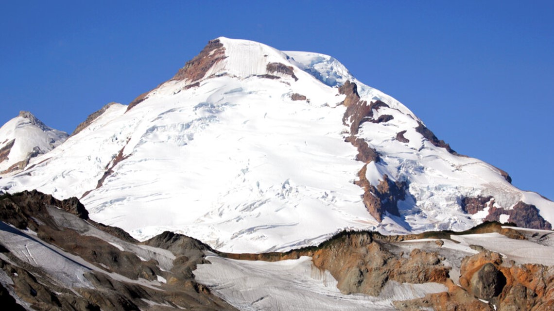
Mount Baker is the third-highest peak in Washington. You can see Mount Baker easily from several locations including Bellingham and the San Juan Islands. Mount Baker has many notable geographic features. Black Buttes is the remainder of an old, eroding volcano. It creates a prominent peak rising off the mountain’s flank. The Twin Sisters are jagged peaks on the southwestern side of Mount Baker. These peaks are much lower than the Black Buttes.
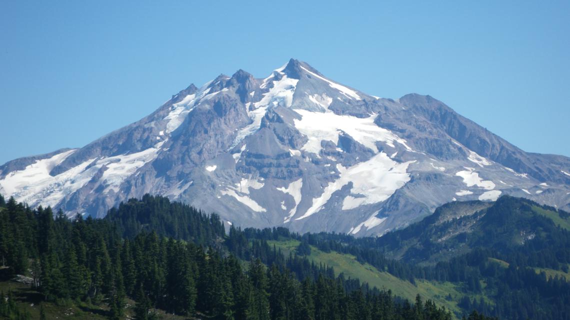
Glacier Peak is not as easy to find. You may be able to see the peak from Seattle, and if you do, you can identify it by its sharp, rocky peak. This is compared to Mount Baker’s rounded peak. You may also see it if you are hiking around southeast Darrington.

Olympic Mountains
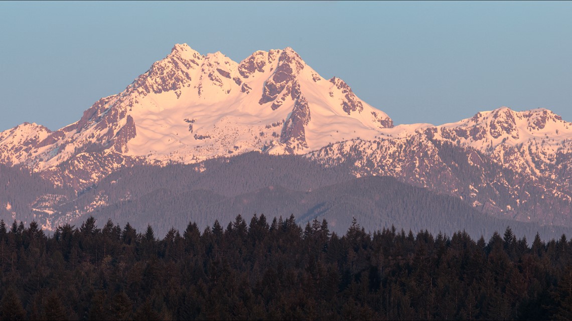
The Olympics are situated within the Olympic National Park on the Olympic Peninsula. Important mountains to note are Mount Constance, The Brothers, and Mount Olympus. Both Mount Constance and The Brothers can be seen from the east and southeast of Puget Sound. They are two of the highest peaks in the Olympic range and are topped by several sharp peaks.
Mount Olympus is the highest mountain in the Olympic range but can be harder to identify than Mount Constance or The Brothers. It is not considered to be a prominent peak, since there are other high peaks surrounding it unlike Mount Rainier or Glacier Peak. You cannot see Mount Olympus from Puget Sound or Seattle. It sits in the middle of the Olympic Peninsula, west of the other peaks. Mount Olympus can be viewed to the north from Hurricane Ridge.

The Olympics cover much less area than the north Cascades but have a high concentration of glaciers. Glaciers are compacted ice that builds up from consistent snowfall over hundreds of years, according to the Washington State Department of Natural Resources. Glaciers grow and reside based on how much snow falls each year versus how much snow melts yearly.
Washington state has the second most glaciers of any state in the U.S. with roughly 3,000 glaciers.

South Cascades
The South Cascades are spread out southeast of Olympia. The remaining three stratovolcanoes, Mount Rainier, Mount Adams and Mount Saint Helens, are part of the South Cascades.
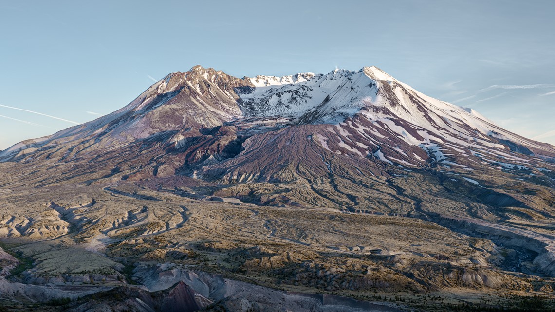
Mount Saint Helens is the most recognizable peak in the state, even though it is the lowest stratovolcano in Washington. The mountain erupted in May 1980, blowing off its top and losing 1,000 feet in elevation. This eruption gave Mount Saint Helens its distinctive crater at its peak. Inside the crater, there is a large bulge. That bulge is the result of lava slowly growing as the mountain works to rebuild itself.

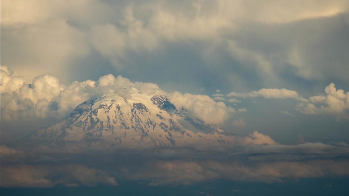
Mount Rainier is the highest stratovolcano and the highest peak in the state. This is the mountain we see on Washington state license plates. Mount Rainier is the 21st most prominent mountain in the world. Prominence measures how high a mountain is compared to the contours around it. Mount Rainier, like Glacier Peak, stands out because there are no other significant peaks around it.
Mount Rainier can be seen from around the state, including Seattle and Olympia. Mount Rainier can look vastly different, depending on what direction you view it from. If you see the mountain from the west or northwest, like the view from Olympia, you will see three separate peaks, Liberty Cap, Columbia Crest, and Success Peak. Liberty Cap is a rocky peak on the northern part of Mount Rainier. Columbia Crest is smooth and cone-shaped. It rests at the top of Mountain Rainier’s peak and is covered in snow. Success Peak is the rocky peak south of Liberty Cap. Liberty Cap and Success Peak were created at the same time, thousands of years ago, in a rock avalanche. They rest 400 feet from Mount Rainier’s summit.
Since from Seattle, Mount Rainier looks more rounded than when seen from the west. You can easily see the Cowlitz Chimneys, jagged rocks, on the mountain’s east side.

Mount Rainier and Mount Saint Helens are the highest priority by the National Volcano Early Warning System, whereas Mount Adams is a “high priority.” Mount Rainier, the highest volcano in the continental U.S., last erupted over 1,000 years ago. Mount Rainier is not expected to erupt again shortly. The U.S. Geological Survey says Mount Saint Helens will likely erupt again in the coming decades, although, the eruption will not likely be on the same scale.
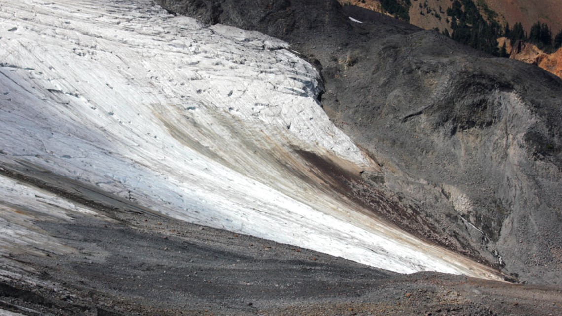
The South Cascades do not have as high a concentration of glaciers, but it does have numerous glaciers. Mount Rainier has 25 named glaciers including the Carbon Glacier, Emmons Glacier, and the Summit Carter Glacier.
Since 1958, Washington’s benchmark glacier the South Cascade Glacier, has shrunk by roughly 2 feet each year.
Eastern Washington
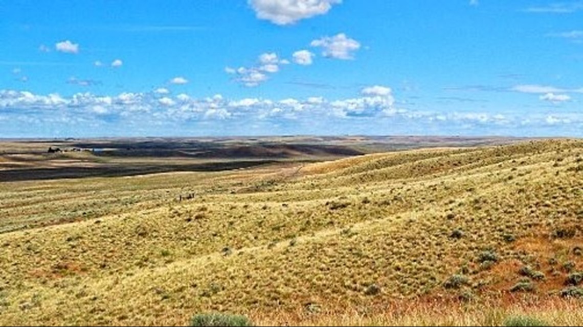
If you are headed to Eastern Washington, plan for some stops along the Columbia Plateau. As the name suggests, the landscape of the plateau (which means level, high ground) is significantly flatter than the rest of the state. Much of the landscape of the Columbia Plateau was formed from basalt, a dark volcanic rock. However, there are still many peaks to discover.

Traveling on the US 195 from Spokane to Pullman, there is the unique peak of Palouse Hills. This peak is interesting because it is shaped like a cone, but it is not a stratovolcano. Further south, along US 12, rise the Blue Mountains. Made from basalt, these mountains were raised by tectonic forces to create their high peaks.
Going back westward, the Yakima Fold Belt is the center of long ridges that raise along the Columbia Basin. Traveling north to south along I-82 will take you on a tour of these ridges. The Columbia Gorge has another eroded volcano, Beacon Rock. It can be seen from SR 14.
You can learn more about Washington’s peaks, discover new hiking trails, and outdoor experiences by visiting the Washington State Department of Natural Resources’ website or the National Parks Service.