SEATTLE — A big warm up is expected this afternoon with temperatures soaring into the 70s.
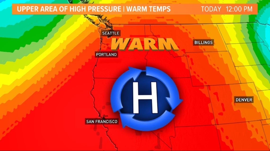
An upper area of high pressure will build over western Washington, which will allow for temperatures to warm under mostly to partly sunny skies.
Along with the upper area of high-pressure that's building over the region, an offshore flow will develop. This will send temperatures to well above average values.

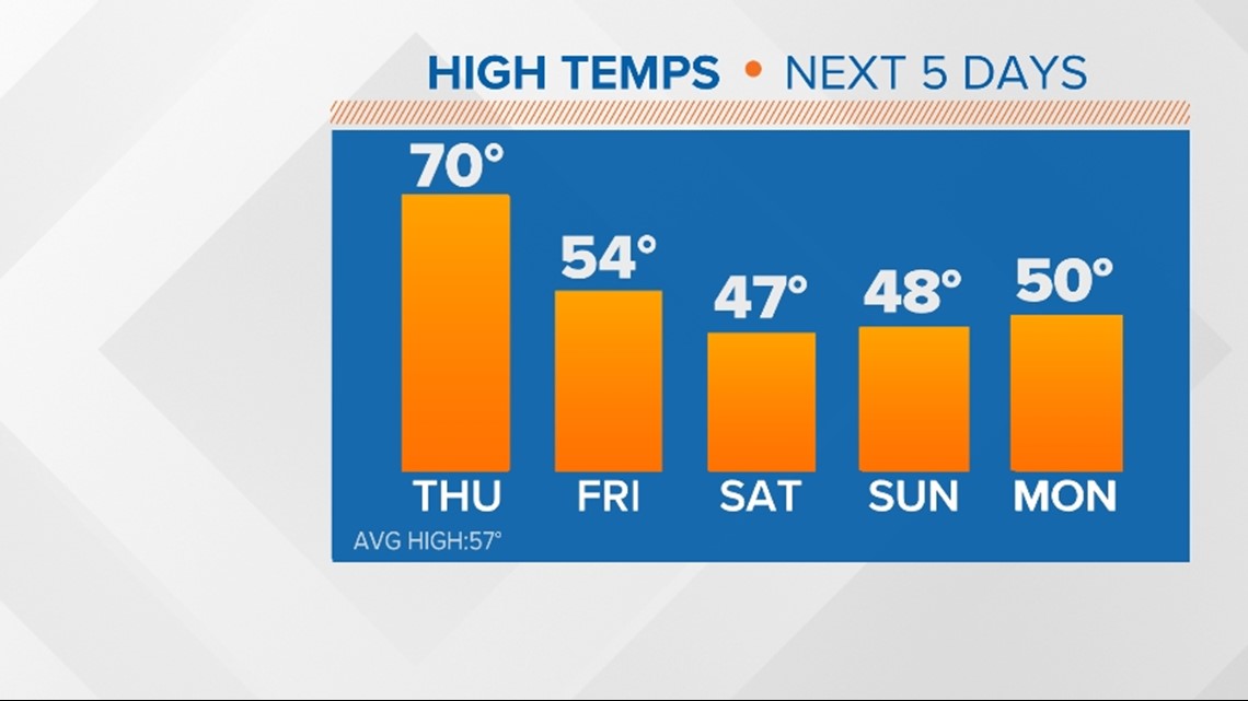
The average high temperature is in the upper 50s for most areas this time of the year, and it's 57 for Seattle specifically. So, temperatures will run more than 10 degrees above average Thursday afternoon.
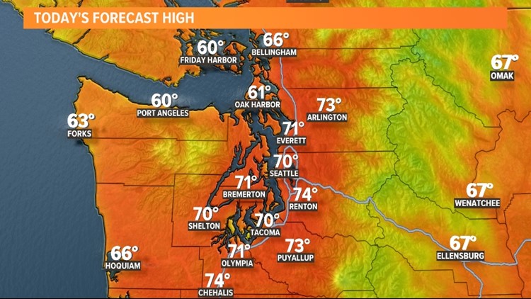
The forecast high in Seattle is 70 degrees. This is forecast as the first 70-degree reading of the season and the first 70-degree day since late September 2021.
In 2021, the first 70-degree day for Seattle was on April 15. If we achieve 70 degrees on Thursday, this will be a week earlier than last year.
While temperatures will be well above average Thursday, they will be far from record highs. The daily record high for April 7 is 78 degrees, which was set back in 2016.
Many areas near the South Sound, Kitsap Peninsula, and Southwest Interior will hit the 70s Thursday afternoon with a few mid-70s being a possibility for the Interior Southwest away from the water. Any location near water will most likely stay in the 60s.


With temperatures, this warm, be careful if you plan on backcountry hiking or hitting the slopes. After a fresh bout of heavy snow recently, paired with temperatures in the 50s for the mountains, the avalanche danger will be elevated this afternoon for the central and northern Cascades.
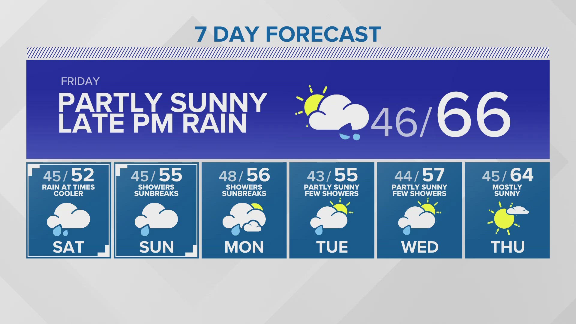
If you're not a fan of temperatures this warm this soon, don't worry, the mild temperatures will be short-lived.
A frontal system will push into western Washington late Thursday and Friday, which will create a chance for a few lowland rain showers and drop the snow levels allowing for mountain snow showers.
An even colder system arrives over the weekend, which could drop the snow levels to around 300 feet by Sunday morning allowing for some patchy areas of lowland snow. No accumulations are currently expected.

Download the KING 5 app to check the interactive radar near you, as well as the latest forecast, cameras and current conditions.