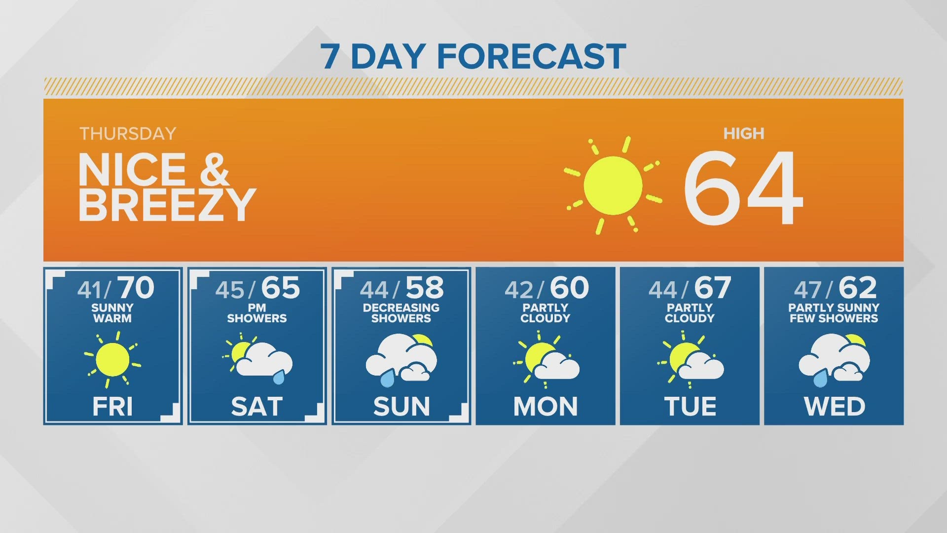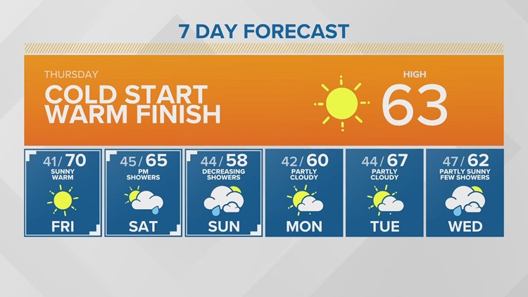
SEATTLE — Puget Sound Extended Forecast
Thursday: Afternoon highs in the mid-60s. Breezy. Frost possible for the South Sound.
Friday: Sunny. Breezy. Morning lows in the upper 30s to mid 40s. Highs in the upper 60s to low 70s.
Saturday/Sunday: Partly sunny skies. Chance for light showers, especially late Saturday into early Sunday. Morning lows in the mid-40s. Afternoon highs in the upper 50s and low 60s.
Monday-Tuesday: Partly cloudy to partly sunny. Morning lows in the upper 30s and lower 40s. Afternoon highs in the low to mid-60s.
Wednesday: Partly sunny with showers. Morning lows in the mid 40s. Highs in the low and mid-60s.
Discussion:
It was another chilly morning early Thursday in the 30s and 40s.
We will warm up nicely on Thursday into the low and mid-60s. Temperatures will dip down into the 30s and 40s tonight and Friday morning. Though we are not expecting widespread frost, a couple of spots in the South Sound, Hood Canal may be cold enough for frost to develop - Even though there is no formal advisory in effect, you may still want to protect your outdoor plants.
A new disturbance moves in Saturday evening, bringing widespread rain and mountain snow Saturday night that will taper to light shower chances through Sunday morning, before clearing Sunday afternoon. Temperatures will briefly cool to the upper 50s Sunday, then warm right back up with more sunshine into early next week. Tuesday could flirt with 70° once again.
A weak system approaches next Wednesday and will produce a few showers and bring high temps back down to the lower 60s.