
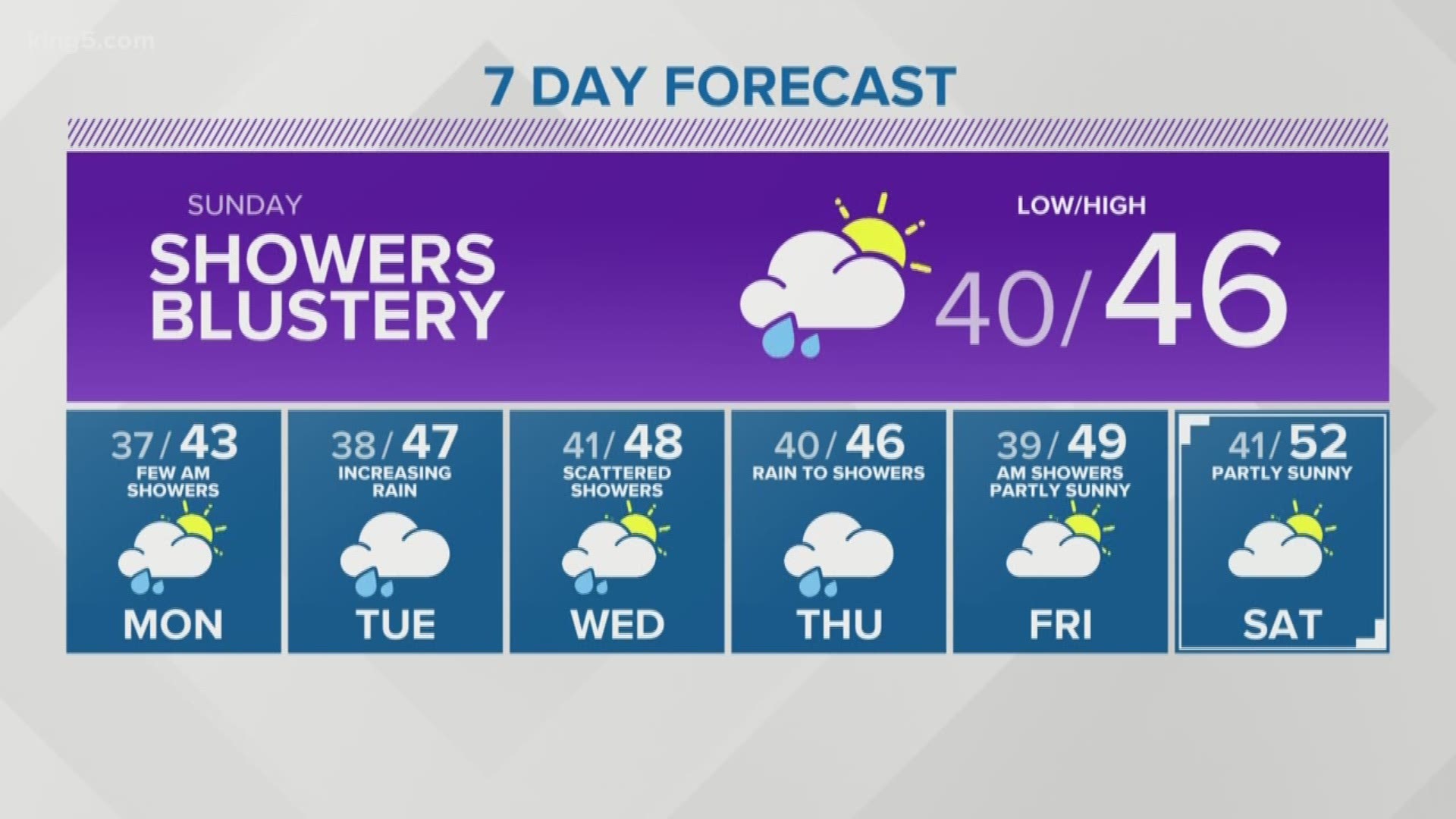
Parts of western Washington may see snowflakes mixing with rain showers late Sunday night into early Monday morning.
Here's the setup: cooler air will filter in behind Sunday morning's frontal system, and the snow level will gradually fall through the day. By Sunday night, the snow level will be around 1,000 feet, possibly as low as 500 feet for areas north of Everett.
There won't be much moisture leftover, but a few snowflakes may mix in with the rain showers. Most of the snow should melt on contact with the ground. Overall, it doesn't look like a big deal.
Temperatures aloft will be warming during the day Monday essentially raising the snow level, and ending any additional threat for lowland snow.
On the mountain passes, snow returns tonight into Sunday with snow levels dropping as low as 2,000 feet. A couple inches overnight, with an additional half foot is possible at all of our mountain passes making for slippery driving. Conditions should gradually improve by Sunday evening, and Monday.