

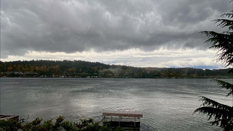
SEATTLE — A series of weather fronts that knocked power out to hundreds of thousands of people will continue to bring rain and windy conditions to western Washington this week.
Rain and wind will continue Tuesday morning and into the afternoon, with a few sunbreaks possible late into the day.
There is a threat of river flooding Wednesday through Friday as the next weather front moving in will bring more rain and mountain snow to the Puget Sound region.
Below is a forecast timeline and what could be in store for western Washington:
Tuesday
The rain trend continues Tuesday with more breezy conditions, but the wind isn’t expected to be as bad as Sunday or Monday. A few sunbreaks could be possible by the end of the day.
Showers are expected to decrease tonight and into Wednesday morning. Highs will be in the upper 40s to low 50s.
A Flood Warning continues for the Skokomish River at Potlatch in Mason County. The river is cresting and is expected to slowly recede Tuesday, according to the National Weather Service (NWS).
Snow levels are expected to sit between 4,500-5,500 feet Tuesday. Higher elevations could get a few inches of new snow, but there will be a minimal impact for the Cascade passes, the NWS said.
Wednesday
A ridge of high pressure should provide a partly sunny break on Wednesday with a few showers. Rain will begin to increase Wednesday afternoon and into the evening.
Snow levels will fluctuate between 4,500 and 5,500 feet with mountain snow at higher elevations.
There is a threat of flooding across western Washington Wednesday through Friday as an atmospheric river moves into the area. Area rivers are expected to sharply rise due to the rain and high snow levels in the mountains.
Thursday
The next stronger storm for continuous rain and wind is expected to develop Wednesday night into Thursday as an atmospheric river moves over western Washington.
Rivers are likely to keep rising, and residents should expect an increased threat of flooding Thursday and Friday. River systems flowing off the central and south Cascades will need to be closely monitored.
Friday into the weekend
Drier weather with clearing skies Friday afternoon will continue Saturday and Sunday. Expect sunshine during both Saturday and Sunday but chilly morning low temperatures.
A storm preparedness kit stocked and ready to go should get you through the next several days of wind, rain, thunderstorms, high surf and flooding.
