

SEATTLE — A strong late-season weather system that brought windy conditions, lowland rain and heavy mountain snow to western Washington began clearing up Tuesday.
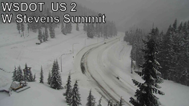
A Winter Storm Warning expired at 5 p.m. for areas of the Cascades of Whatcom, Skagit, Snohomish and King counties, according to the National Weather Service (NWS). Additional snow accumulations of 1-8 inches were possible in areas above 2,500 feet.
The warning included the Mount Baker Ski Area, along with Stevens and Snoqualmie passes.
A Winter Storm Warning for areas of the Cascades of Pierce and Lewis counties expired Tuesday morning.
The NWS said drivers should plan on “very difficult travel.”
Aside from lowland rain and heavy mountain snow, strong winds and powerful swells along the coast were also expected.
A High Surf Warning for the southern Washington coast expired at 11 a.m. Tuesday.
A High Surf Advisory for the north and central Washington coast expired at 5 p.m. The NWS warned of large waves and hazardous surf conditions with a high potential for sneaker waves - destructive waves that can wash over beaches unexpectedly.
Widespread rain is expected to taper off Tuesday with sunbreaks. A ridge of high pressure will build into the state later Tuesday and Wednesday, bringing warmer temperatures and more sunshine.
The nicest day of the week is expected Thursday with temperatures well into the 60s and possibly 70 with ample sunshine.
Another cold system is forecast to arrive next weekend that could put snow levels below 1,000 ft. by Sunday.
