
Get ready for a few days of wet and windy weather with lots of mountain snow.
A wet, blustery weather pattern will take us through the first half of this week. Showery weather Sunday afternoon will lead to more wet weather Monday, and a stronger system arriving Tuesday.
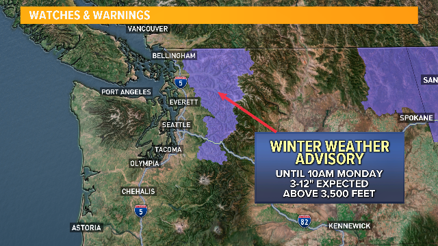
A Winter Weather Advisory is in effect for the central and north Cascades until Monday morning for elevations above 3,500 feet. Anywhere from 3-to-12 inches of new snow is forecast to fall here. A Winter Storm Watch will be in effect 4 p.m. Monday until 1 a.m. Wednesday for the north and central Cascades and until 4 p.m. Tuesday for the Olympics.
After a very brief lull Monday, a low-pressure system will rapidly develop offshore pulling through northwest Washington and southern British Columbia Tuesday. This will bring widespread rain and some wind.
You can watch this low develop on forecast surface maps. By 10 a.m. Monday, the low begins to deepen to a 1012 millibar low.
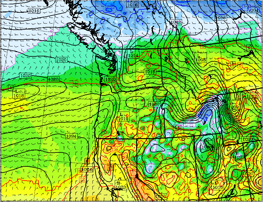
By 10 p.m. Monday, it's down to 1010 millibars.
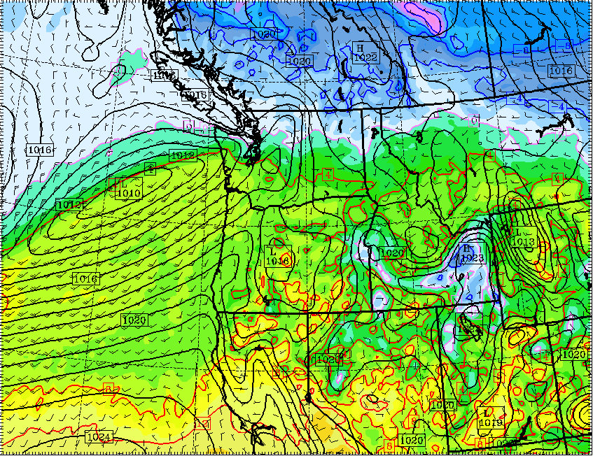
By 10 a.m. Tuesday, it shoots down to 996 millibars.
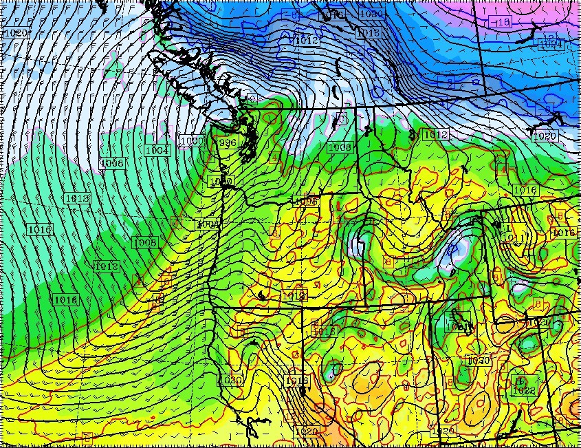
While a 996 millibar low isn't anything too crazy, a low-pressure system dropping close to 20 millibars in 24 hours is fairly significant, which has us keeping a close eye on this system.
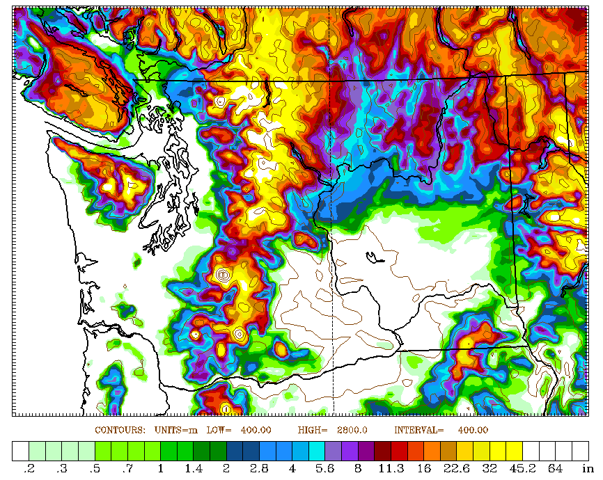
This is likely going to be a heavy rain producer, and with a snow level lowering to 3,000 feet and heavy mountain snow. The 72-hour accumulating snow forecast model easily has a couple of feet of snow over higher elevations, and plenty at pass level too. Expect difficult travel over all mountain passes Monday night through at least Wednesday morning.
Here's what's interesting: beyond Wednesday, our weather pattern quiets down again. Another strong ridge of high pressure sits offshore bringing back the chilly mornings and mostly sunny skies.
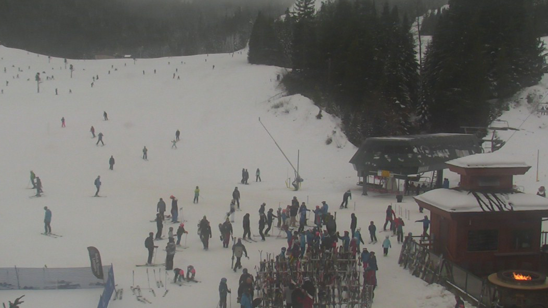
What's different about this stretch versus the pattern we just got out of is the overall atmosphere will be much colder. Instead of a strong temperature inversion, and the mountains staying in the 50s, it should be cold enough for ski resorts to produce artificial snow.
Expect to see some great holiday skiing and snowboarding.
