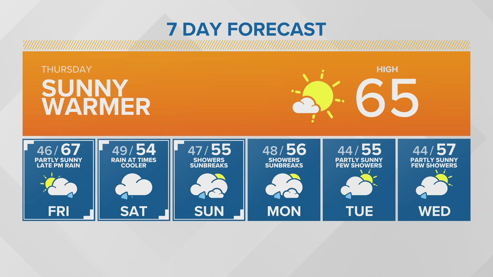

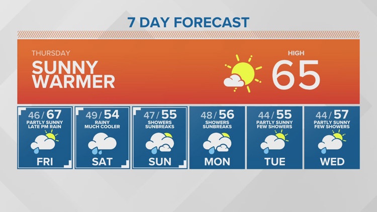
SEATTLE — Puget Sound Extended Forecast
Thursday: Sunny and warmer. Highs in the low to mid-60s.
Friday: Partly sunny with increasing clouds. Increasing chance of rain in the late afternoon / evening. Warm. Morning lows in low to mid-40s. Highs in the mid-upper 60s.
Saturday: Rain at times - especially Everett southward. Morning lows in the mid to upper 40s. High temperature in the mid 50s.
Sunday-Monday: Showers mixed with sunbreaks. Morning lows in the mid-40s. Highs in the mid-50s.
Tuesday-Wednesday: Partly sunny with a few showers. Lows in the low to mid 40s. Highs in the mid and upper 50s.
Discussion:
High pressure is moving into the state today bringing us sunshine and warming our highs into the low to mid 60s. The high pressure will move east of the Cascades by Friday afternoon allowing a warm front to spread rain back into Puget Sound in the late afternoon or evening on Friday.
The warm front will stall over western Washington for a rainy Saturday for the Opening Day of Boating season. Highs will drop back to the mid 50s most places. The front will dissipate and move east early Sunday but leave behind cool showery air for off and on showers mixed with sunbreaks Sunday and Monday.
Look for drying and warming as we head into midweek next week.