SEATTLE — After warm air kept snow out of parts of King County and further south, colder air is expected to move back into the area, bringing limited snowfall and freezing temps during the day Tuesday.
Overall, the system is expected to dump anywhere between two to eight inches of snow before departing Tuesday evening. Seattle is expected to get lesser accumulations while areas further north, like Bellingham could be dealing with eight inches by the time the flurries are over, according to the KING 5 Weather Team.
Temperatures are expected to get dangerously low further north, including in Whatcom, Skagit and Snohomish counties, dropping into the low teens and 20s.
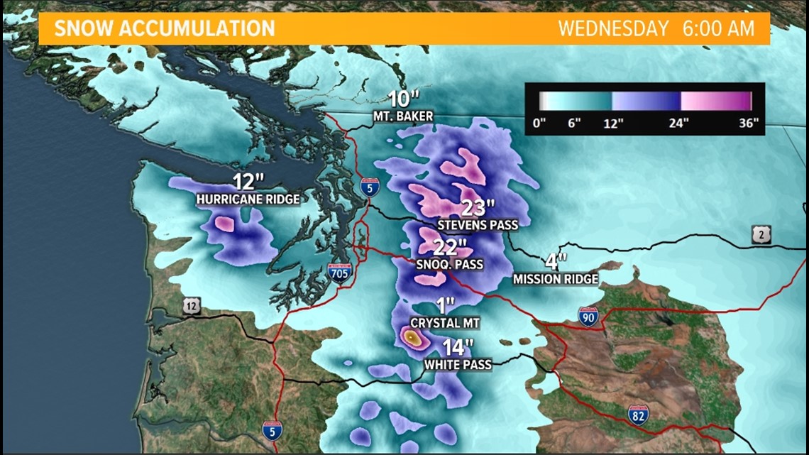
Those with plans to travel across I-90 should consider rescheduling, as the mountain passes could see one to two feet of accumulation before the system moves on.
Winter Storm Warning
A Winter Storm Warning went into effect at 7 p.m. on Monday evening and will remain in effect until Tuesday at 7 p.m. for the Puget Sound, Kitsap Peninsula, the San Juan Islands and the central and south Cascade mountains.
Accumulations of two to eight inches of snow could cause significant travel issues for areas impacted by the warning. Areas north of Seattle, like Bellingham are expected to get a majority of the snow. The mountains could get a significant blast, with a possible one to two feet of accumulations.

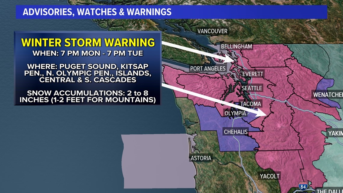
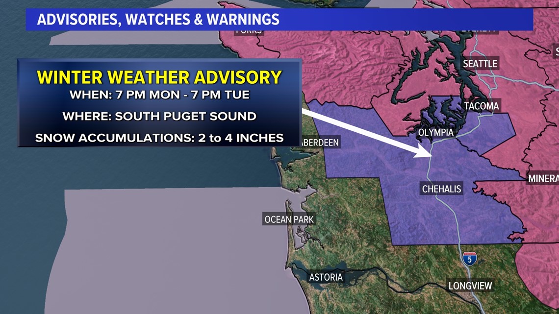
A Winter Weather Advisory will go into effect at 7 p.m. Monday for the south Puget Sound, including Tacoma, Olympia, Aberdeen and Chehalis, which can expect to see from two to four inches of accumulation.

Snow timeline
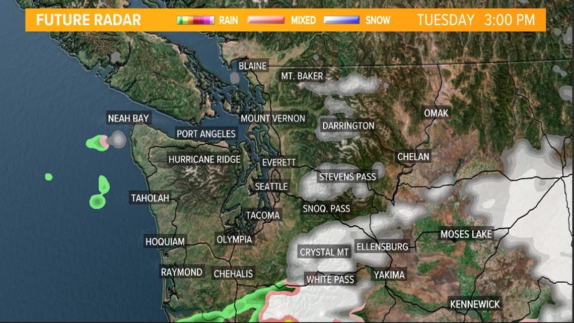
Tuesday afternoon
As the front moves southeast through western Washington the southerly winds will stop and turn back to northerly, pulling the cold air south again and dropping the snow line southward.
The snow line could make it all the way to Olympia later on Tuesday. But even though the snow level is falling back to near sea level, only a trace to 1 inch is expected during the day.
By Tuesday evening, the snow begins to depart the Puget Sound lowlands with only spotty lingering snow showers Tuesday night near central Puget Sound extending west toward the northern Olympic Peninsula.
The cold air stays in place Wednesday for another chilly day with mainly snow flurries and highs in the upper 20s and low 30s. Whatcom County will be even colder with highs in the upper teens and low 20. A chance of snow returns on Thursday afternoon.

Accumulations: Lowlands
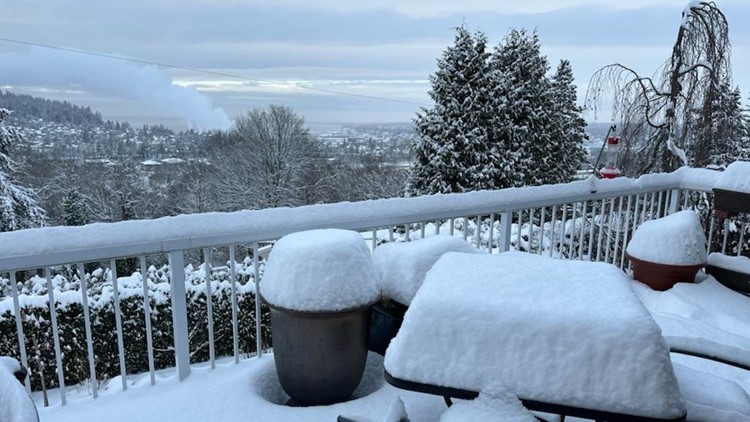
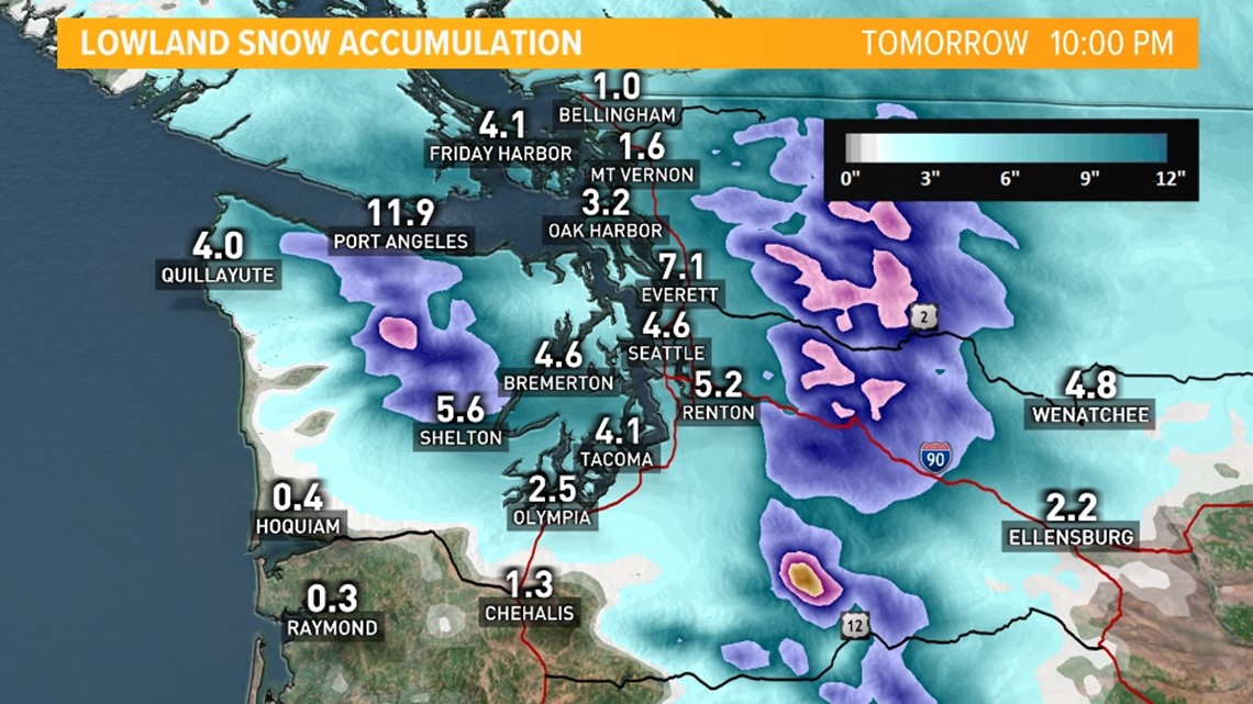
Widespread lowland accumulations of 2-7 inches are expected by Tuesday evening. Areas farther south and near water see lighter accumulations of up to one inch with areas farther north and the higher hilltops seeing closer to four inches.
The favored areas to see higher accumulations include the Cascade foothill communities of King and Snohomish counties, north of Seattle near Everett and across the northern Olympic Peninsula.
Snow that accumulated in Tacoma and Olympia on Monday night could melt as snow transitions into rain on Tuesday. If the rain/snow line shifts farther north into downtown Seattle, this will drastically reduce potential snow accumulations for the Seattle metro area. This is not expected to be a major snow event for the Seattle area, according to the KING 5 Weather Team.
Accumulations will be enough to impact travel, especially in the hillier communities, on secondary roadways, and on elevated roads, bridges and overpasses.

Accumulations: Mountains
The Cascade passes will see up to two feet of snow Monday night through Tuesday. Pass conditions will likely be dangerous so check the pass conditions before venturing out over the mountains.
It's recommended those looking to travel on Tuesday reconsider and try again once this system has passed.
A Winter Storm Watch went into effect Monday night, continuing through Tuesday night for the Cascade mountains.

