
SEATTLE — Western Washington saw a variety of weather in 2022, breaking records throughout the year.
Here’s a look back at some of the milestones.
Spring was overall wet and cold. April of 2022 was the third coldest and 10th wettest April on record statewide.
Summer shattered records and will go down in history as the warmest and driest summer on record.
Between June 21 and Sept. 21, Sea-Tac recorded 0.5 inch of rain. The average is 2.98” during that time frame, making it the driest summer yet.
Seattle-Tacoma International Airport observed a record 13 days at 90 degrees or warmer during the same time frame. Plus, Sea-Tac hit 90 degrees or warmer six days in a row, making that the longest 90-degree or warmer stretch yet.
The hot and dry trend carried into fall, with October ranking as the warmest October since records began in 1895 for the state of Washington as a whole. The average temperature was 6.6 degrees warmer than the 1991-2020 normal.
October 16, when the average daily high temperature at Sea-Tac is 60 degrees, the airport hit 88 degrees, breaking the daily record of 72 degrees and becoming the latest 80-degree day or warmer for the calendar year ever.
Wildfire smoke also dominated September and October because of nearby fires, leading to long stretches of bad air quality. At one point in October, Seattle had the worst air quality in the world with an AQI of 245.
Winter 2022 didn’t hold back, and the first few days of the calendar year brought a historic snowstorm and several feet of snow to the Cascades.
Winter began Dec. 21 and brought chaotic weather to end the calendar year. A freezing rain event impacted Western Washington Dec. 23, causing widespread icy roads and sidewalks. Flights at Sea-Tac were canceled, leading to a travel nightmare ahead of the Christmas holiday.
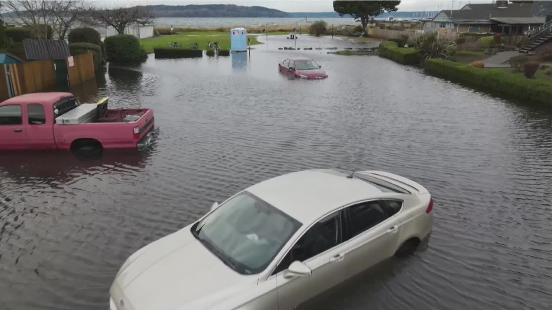
High tides Dec. 27 led to flooding along the coast. Olympia saw a high tide of 18.4 feet, setting a record for highest tide in history.
Snoqualmie Pass had the highest snowfall in 20 years by January 3, with 236 inches recorded. The previous records were 229 inches in 2007 and 212 inches in 2004. The four main passes closed for multiple days starting January 6.
Overall, rain totals ended about normal. Average annual rainfall at Sea-Tac is 39.34 inches and 2022 brought in 40.27 inches for the year.