
SEATTLE — A big change to our overall weather pattern in western Washington is forecast to happen the last week of August.
For the first time in a long time, we will see a persistent easterly offshore flow which will help give us a streak of warm temperatures, as well as potentially give us some wildfire smoke.
Before we get too hyped up, let's point out there are no major wildfires currently burning in eastern Washington or interior British Columbia.
The map below shows where the current wildfires are located:

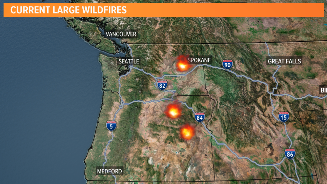
The biggest fire is the Williams Flats Fire which had burned around 45,000 acres and was about 90% contained Thursday morning. That fire isn't producing much smoke, so even with an easterly flow, it likely won't bring much smoke to western Washington.
This time last year, a similar weather pattern developed with a strong surface high over interior B.C. The strong easterly wind carried heavy smoke over the Puget Sound region.

This year, there aren't as many major wildfires, and this probably won't end up being as big of a deal as last year's wildfire smoke.
We stay seasonably cool the rest of this week with a warming trend beginning Monday.
We should mix in a few days well into the 80s, and possibly the 90s, by the middle of next week. That will be the most noticeable change with this weather pattern.
It just goes to show that we still have plenty of summer weather left.