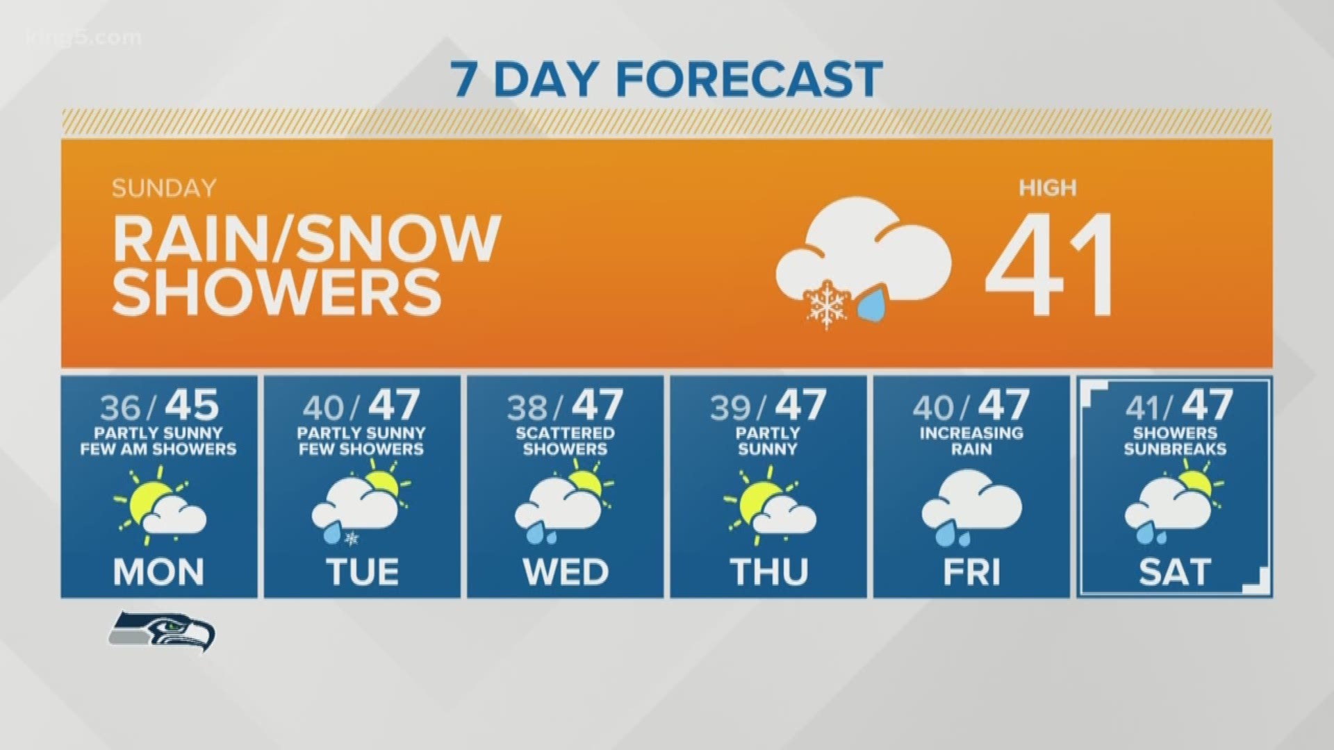
SEATTLE — Showers moved through western Washington from the south on Sunday morning, starting out as wet snow.
The snow hit parts the Puget Sound and Southwest Interior before 7 a.m. The KING 5 School Net camera showed a dusting of snow at the parking lot of Ground Mounds Elementary School in Rochester, Washington. Just North of Aberdeen, at Wishkah Valley School, a rain/snow mix fell just after 7:15 a.m.
While a few snowflakes will continue to fall, most places won't see any accumulating snow. Areas with the best chance include the Southwest Interior, Hood Canal, and the Kitsap Peninsula where up to a half inch is possible. Overall, it should not have a major impact on travel.
Any accumulating snow should be limited to a dusting on lawns and foliage, and mainly just wet roads are expected for Sunday morning travelers.
Also see | Western Washington forecast
Did you get any snow? Let us know on the KING 5 Facebook page:
A KING 5 viewer named JoDyne Beck shared a photo from Spanaway, which got a dusting of snow early Sunday:
We should see a transition to all rain in the lowlands by midday as temperatures continue to warm. Any snow that does accumulate should melt fairly quickly.
The showers are expected to wrap up in the afternoon. Highs on Sunday will be in the low 40s.
The Cascade Mountains are expected to receive a couple inches of snow with this system, but they won’t get any significant accumulation until at least next weekend.
Whistler Blackcomb ski resort started its ski season Thursday, and Crystal Mountain and Mission Ridge ski areas both opened Friday.
RELATED: The recipe for snowfall in Seattle