

No additional lowland snow is expected today after a winter storm brought heavy rain and snow to the Puget Sound region on Monday.
Snow began falling near the Canadian border early in the day, then spreading south to Mukilteo, Seattle and Tacoma in the evening.
By about 9 p.m. Monday, snowfall had dissipated and rain showers returned, melting any accumulations. See photos and video on KING 5's Twitter page.
Puget Sound was first drenched by heavy rain Monday afternoon, including significant street flooding from Lynnwood and Kirkland to West Seattle, before those snow flurries moved in.
Temperatures dropped into the 30s as nightfall began on the first day of winter. Heavier bands of precipitation combined with the cooldown created wet snowflakes in the lowlands.
Tuesday is expected to remain cold but mostly dry and a few degrees above freezing.
An upper ridge will bring dry weather through Thursday, according to the National Weather Service.
A frontal system could bring some rain Friday.
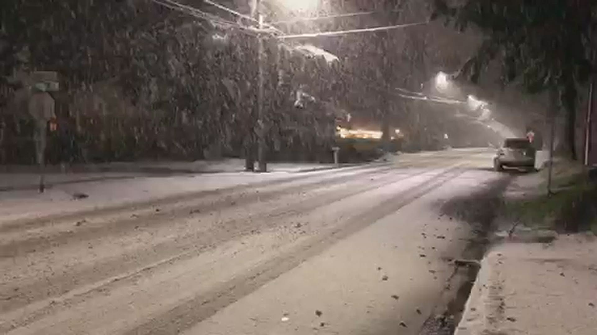
Snow first fell Monday morning in Bellingham, Blaine, and then flurries stretched into Snohomish and King counties by the evening, including Mill Creek and Seattle's Phinney Ridge neighborhood. The band of snow continued moving south through Auburn and Burien to Tacoma.
RELATED: Western Washington forecast
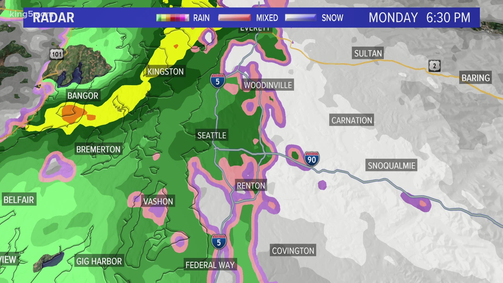
A Winter Weather Advisory is in effect for the Cascades of Snohomish, King, Pierce, and Lewis counties from 4 p.m. Monday to 4 a.m. Tuesday for areas above 2,000 feet, according to the National Weather Service.
Snow accumulations of 12 to 18 inches are possible for the Olympics.