
SEATTLE — Rainfall from the second of back-to-back atmospheric rivers decreased Monday as a cold front settles in.
An atmospheric river is a long, narrow region in the atmosphere, like a river in the sky, that brings water vapor from the tropics, according to the National Oceanic and Atmospheric Administration.
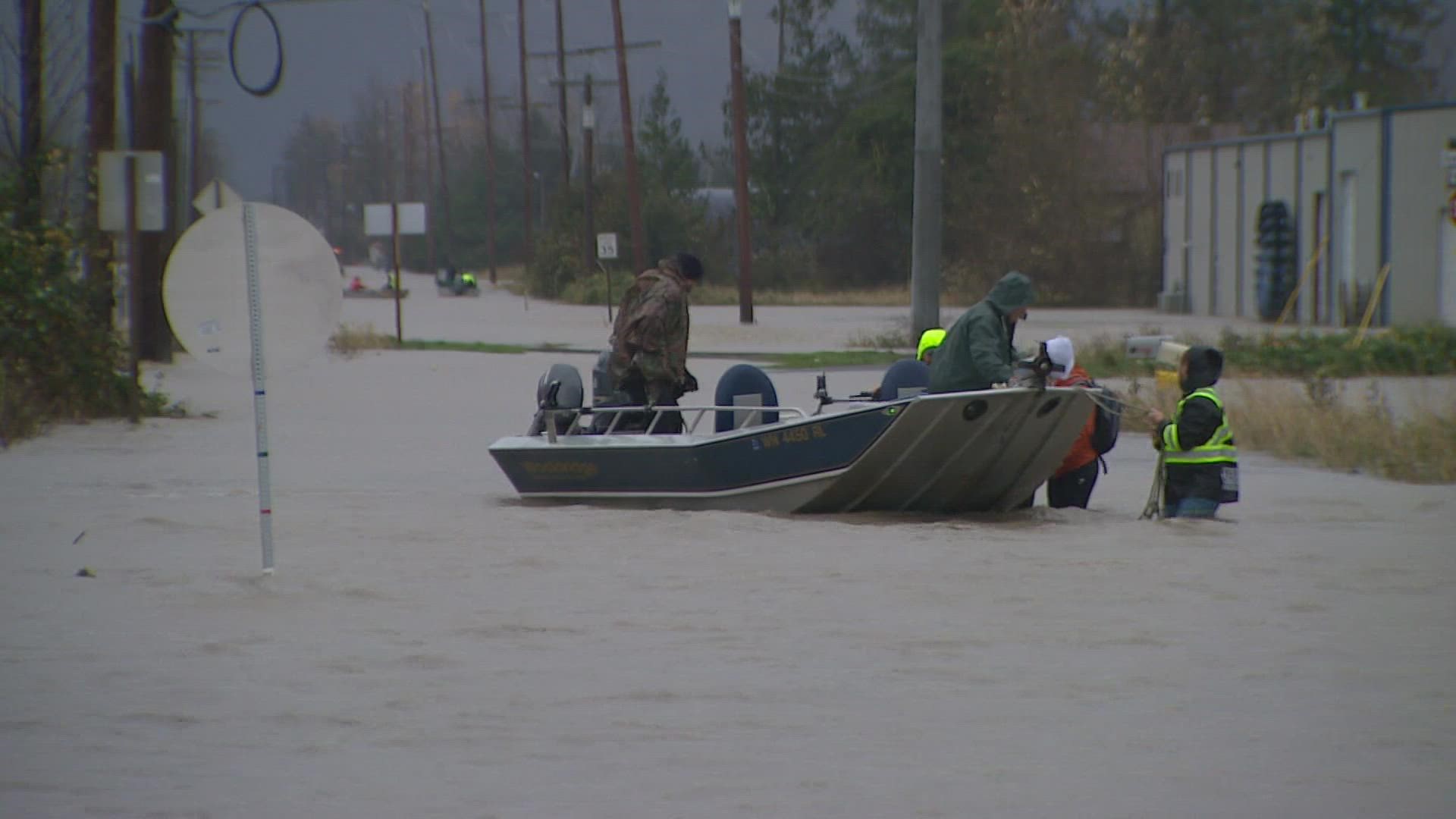
The National Weather Service (NWS) said river flooding has been the biggest impact, with the Cascades and Olympics taking the brunt of the storm.
At least 500 residents have been displaced in Whatcom County due to flooding and landslides.
Below is a timeline of what to expect:
Monday
A cold front arrived in the afternoon, dropping snow levels down to 1,500 to 2,000 feet by Monday night into Tuesday.
Flooding
A Flood Watch remains in effect through Tuesday afternoon for many areas around western Washington, including parts of Clallam, Grays Harbor, Jefferson, King, Mason, Pierce, Skagit, Snohomish and Whatcom counties.
A Flood Advisory is in effect for parts of northwest Washington, including Clallam and San Juan counties, through Monday afternoon. The NWS said urban and small stream flooding is possible due to excessive rainfall.
The NWS issued a Flood Warning for portions of northwest Washington, including Skagit and Whatcom counties, until 10 p.m. Monday. The weather service said between 3.5 and 4.5 inches of rain had fallen in the area since Sunday morning, with another 1-2 inches possible Monday.
Flood Warnings are broken up by county below:
Clallam County
- Bogachiel River near La Push: Expected to crest in major flood stage Monday afternoon and fall below flood stage by Monday evening
- Elwha River at McDonald Bridge: Expected to crest in moderate flood stage by Monday evening
King County
- Snoqualmie River near Carnation: Crested Tuesday morning in moderate flood stage and expected to continue falling
Mason County
- Skokomish River at Potlatch: Expected to crest in moderate flood stage by Tuesday morning
Skagit County
- Samish River at Burlington: Crested in moderate flood stage Monday afternoon and is expected to continue falling
- Skagit River near Mount Vernon: Expected to crest in major flood stage late Tuesday morning and fall below flood stage Wednesday afternoon
- Skagit River near Concrete: Crested Monday afternoon in major flood stage and will fall below flood stage by Wednesday morning
Snohomish County
- Stillaguamish River at Arlington: Expected to crest in minor flood stage Monday afternoon and fall below flood stage after midnight
- Snohomish River at Snohomish: Expected to fluctuate above flood stage Monday and fall below flood stage Tuesday afternoon
- Snohomish River near Monroe: Expected to crest in minor flood stage Monday afternoon before falling below flood stage late Monday night
- Skykomish River near Gold Bar: Expected to rise to minor flood stage Monday afternoon before falling below flood stage Monday night
Whatcom County
- South Fork Nooksack River at Saxon Bridge: Expected to crest in moderate flood stage late Monday afternoon, falling below flood stage Monday evening
- Nooksack River at Ferndale: Expected to crest in moderate flood stage Tuesday afternoon and fall below flood stage Thursday morning
- Nooksack River at North Cedarville: Reaching its crest in major flood stage midday Monday with overflow expected to continue until Tuesday morning
The NWS said residents can expect widespread river flooding, even in areas that haven’t reached moderate or major flood stage in northern counties.
The NWS said Monday that four rivers reached record levels during this flood event: The Nooksack River at Cedarville, the Samish River near Burlington, the Bogachiel River near La Push and the Calawah River near Forks.
According to the Northwest River Forecast Center, the Skagit River in Concrete crested around 38 feet as of 9 a.m. Monday, and the Samish River crested at 13.33 feet Monday morning. The Skagit River in Mount Vernon is forecast to crest at 37.59 feet Tuesday at 10 a.m. The forecast center said, “these levels are comparable to the 2009 Skagit County flood event.”
Wind
Gusty winds will continue around western Washington on Monday with the strongest winds forecast near the coast, the Straight of Juan de Fuca, along the shoreline of Snohomish, Skagit, and Whatcom counties, and areas near the water in the Puget Sound lowlands, according to the NWS.
The gusty winds will continue until after dark before they begin to diminish, according to KING 5 Meteorologist Rich Marriott.
The NWS issued a Wind Advisory for Seattle, Bremerton, Hood Canal, Tacoma and the Southwest Interior until 4 p.m. Monday. The forecast calls for southwest winds 25 to 35 mph, with gusts up to 50 mph possible.
A Wind Advisory also remains in effect until Monday 7 p.m. for the Eastern Strait of Juan de Fuca, the north Washington coast, and western Whatcom and San Juan counties with winds 25 to 45 mph and gusts up to 50 mph.
A Wind Advisory is in effect for the Admiralty Inlet area until 10 a.m. Monday. A High Wind Warning will go into effect for the area at 10 a.m. and last until 7 p.m. Monday, with west winds 35 to 45 mph and gusts up to 60 mph expected. A Wind Advisory for the Everett area will also turn into a High Wind Warning at 10 a.m. and last until 7 p.m. Monday.
The extended period of gusty wind will add additional stress to saturated soils and tree roots.
Cooler temperatures
Sea-Tac Airport tied the record daily high temperature of 62 degrees Monday morning, but much cooler air will move into the area by the afternoon, dropping temperatures into the 40s.
The cold front will drop snow levels very fast, down to 1,500 to 2,000 feet Monday evening, and mountain snow is expected for all passes.
The NWS issued Winter Weather Advisory from 4 p.m. Monday until 10 a.m. Tuesday for areas of the Cascades above 1,500 feet. The advisory includes Stevens and Snoqualmie passes. The weather service said up to 14 inches of snow is possible, with wind gusts as high as 40 mph.
Tuesday into mid-week
There will be a few leftover showers Tuesday, mainly in the convergence zone, but the trend will be for more sunshine as the day progresses. Winds are also expected to ease Tuesday.
Temperatures Monday into Tuesday will also see a startling turn. Lows Monday morning will be in the mid to upper 50s. Lows Tuesday morning will drop to the mid to upper 30s, according to the NWS.
The NWS said some lowland areas could see freezing temperatures Wednesday morning, “especially over the East Puget Sound lowlands, the Southwest Interior, and Lower Chehalis Valley.”