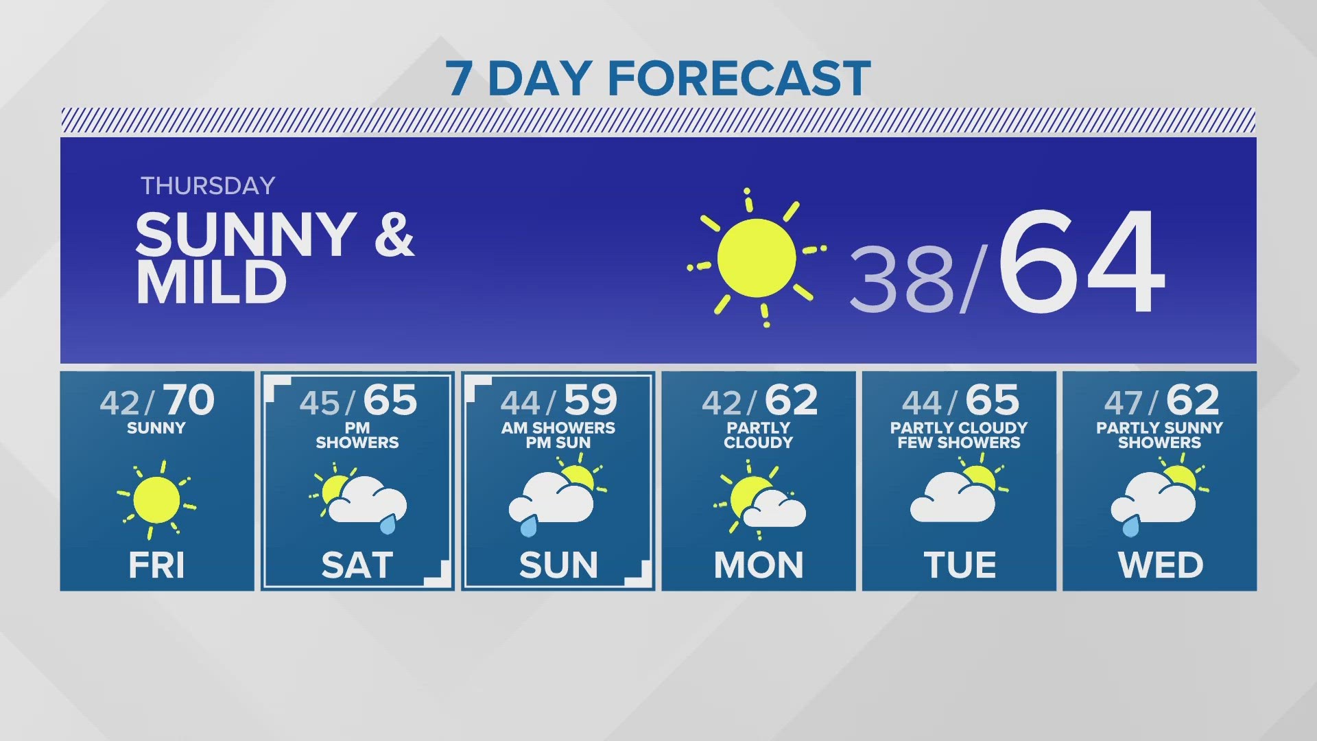
SEATTLE — The past two weeks of November have been quiet and dry for western Washington.
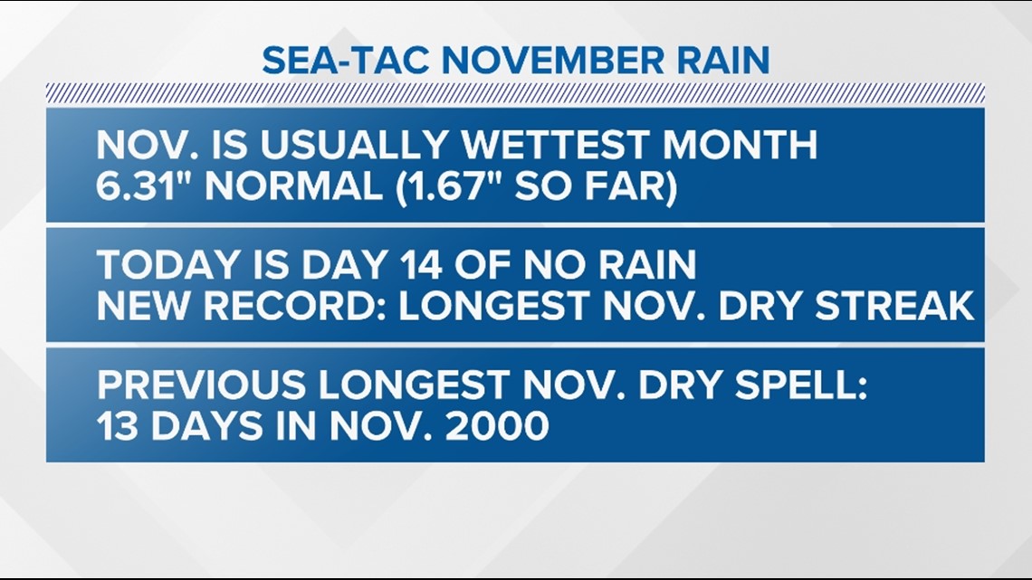
November is typically the wettest month of the year at Sea-Tac, averaging 6.31 inches of precipitation. This November, Sea-Tac has only picked up 1.67 inches of rain and is in the midst of a 14-day dry streak.
This is the longest recorded dry streak during the month of November at the airport. The previous was 13 days back in 2000.

Changes arrive by Tuesday with a strong frontal system arriving for western Washington.
Timeline
Spotty rain showers increase along the Washington coast and for the Olympic Peninsula late Monday night.
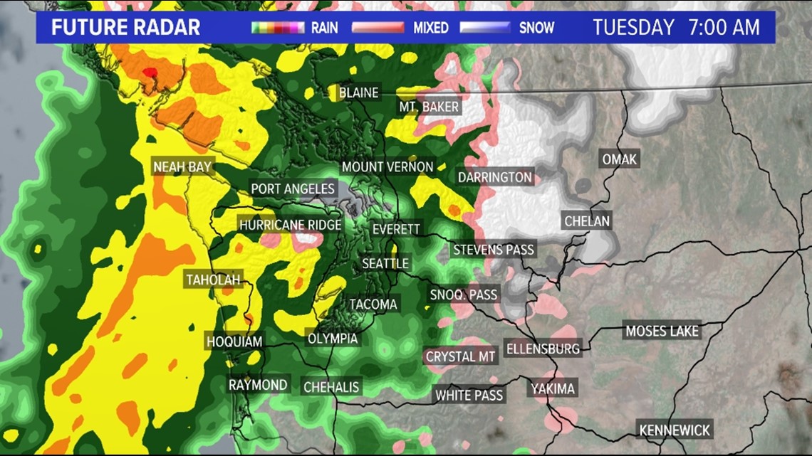
Those rain showers increase in coverage and intensity by Tuesday morning, covering Puget Sound just in time for the Tuesday morning rush hour.
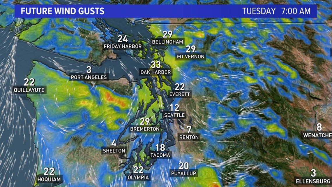
Pockets of moderate rain are possible so give yourself extra time during the morning commute. Gusty winds will also begin to move into western Washington with winds gusting between 20 to 30 mph.
Radar forecast Tuesday morning

Wind gust forecast Tuesday morning

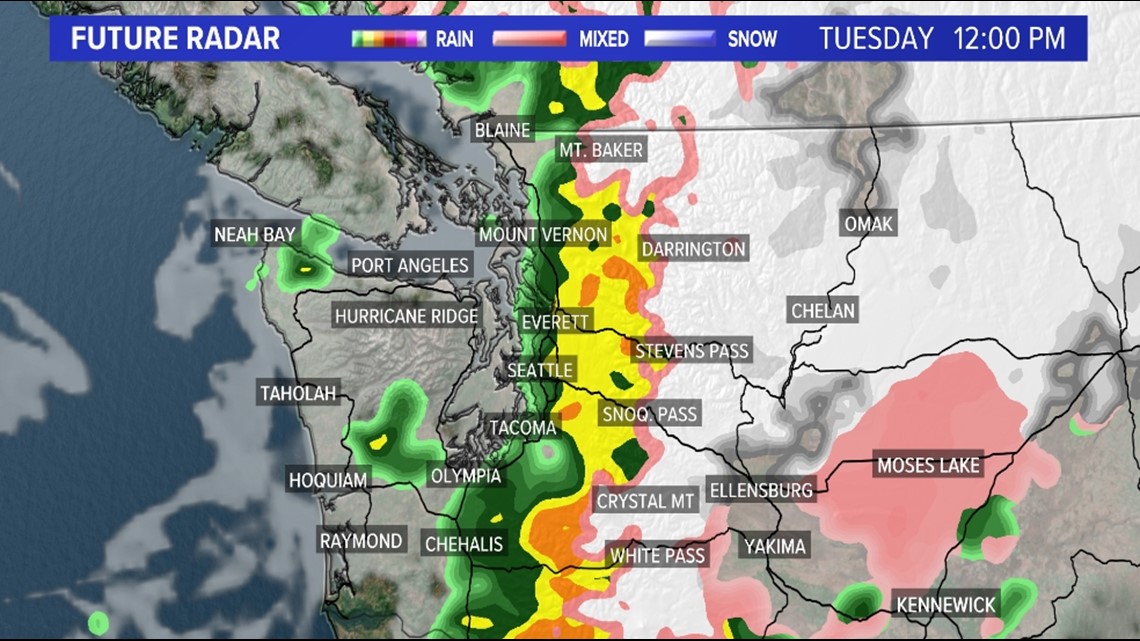
Rain will gradually diminish in coverage and intensity from west to east across the region by midday Tuesday.
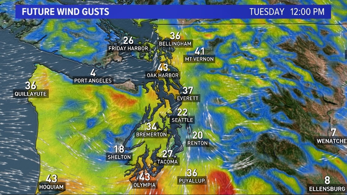
The Olympic Peninsula will begin to dry out by lunchtime with the backend of the precipitation moving into Puget Sound. The heaviest rain will be from I-5 east into the Cascade foothills. The gusty winds up between 25 to 35 mph will continue at this time with the strongest gusts near the water and for the San Juan Islands and Whidbey Island.
Radar forecast Tuesday midday

Wind gust forecast Tuesday midday

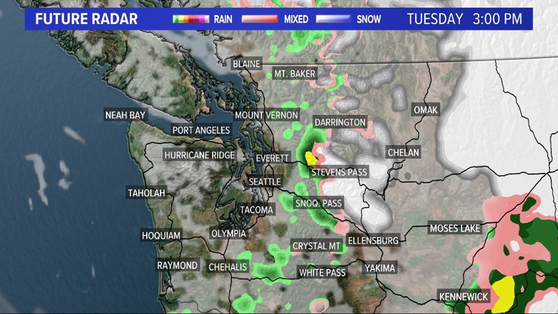
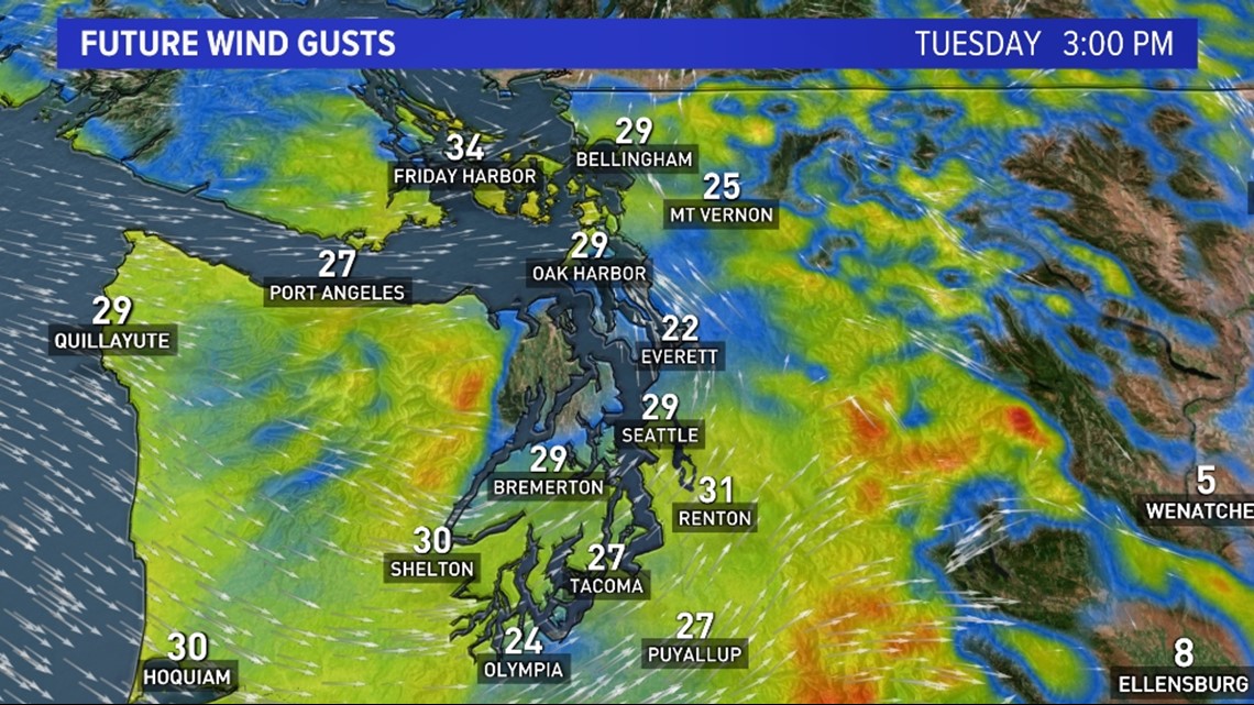
Most of the precipitation ends for western Washington Tuesday afternoon with a mixture of sunbreaks and a few sprinkles. The exception is in parts of King and Snohomish counties where a convergence zone will set up along with in the Cascades.
The snow level will begin to fall at this time, so snow is possible for Stevens Pass and Snoqualmie Pass. Gusty winds will continue Tuesday afternoon for most of western Washington.
Radar forecast Tuesday afternoon

Wind gust forecast Tuesday afternoon

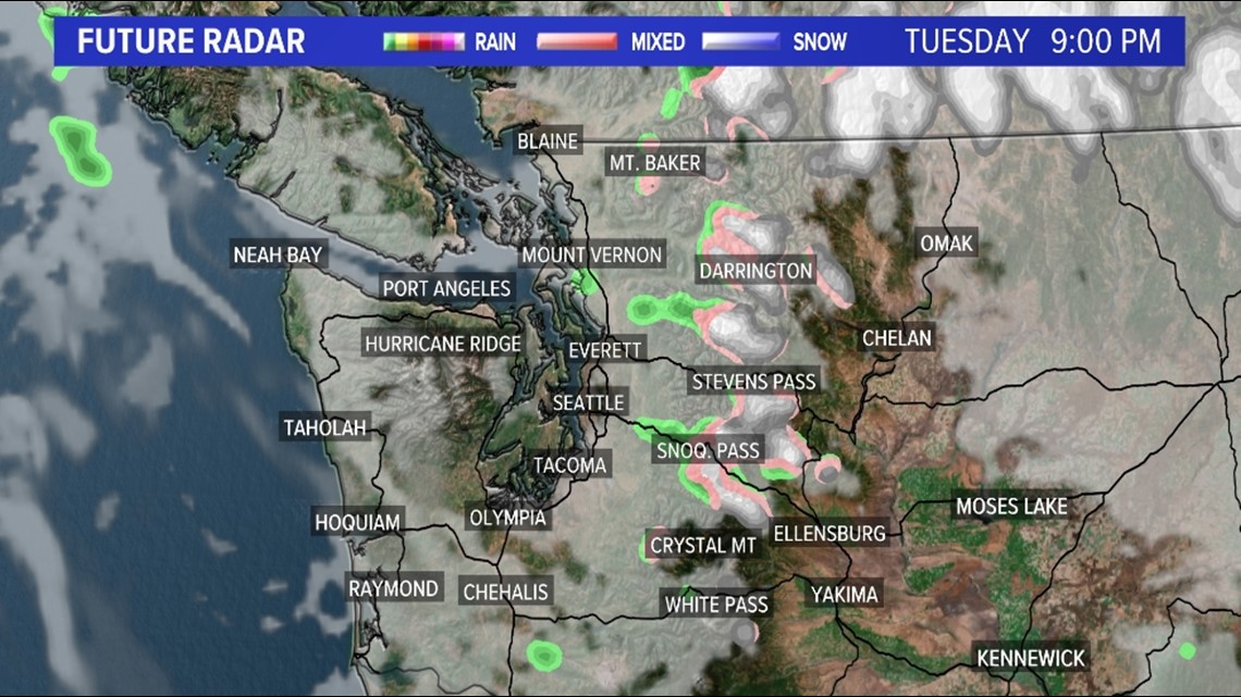
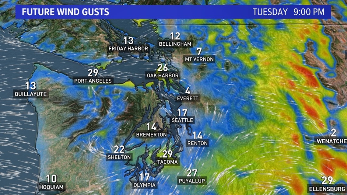
The snow continues Tuesday evening for the Cascades including the passes.
The remainder of western Washington appears to stay largely dry Tuesday evening. The winds begin to diminish during the evening and overnight hours Tuesday.
Radar forecast Tuesday evening

Wind gust forecast Tuesday evening

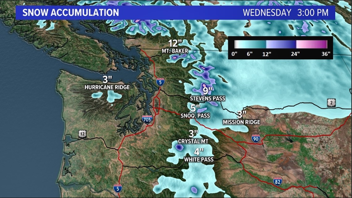
Rain and snow accumulation forecast
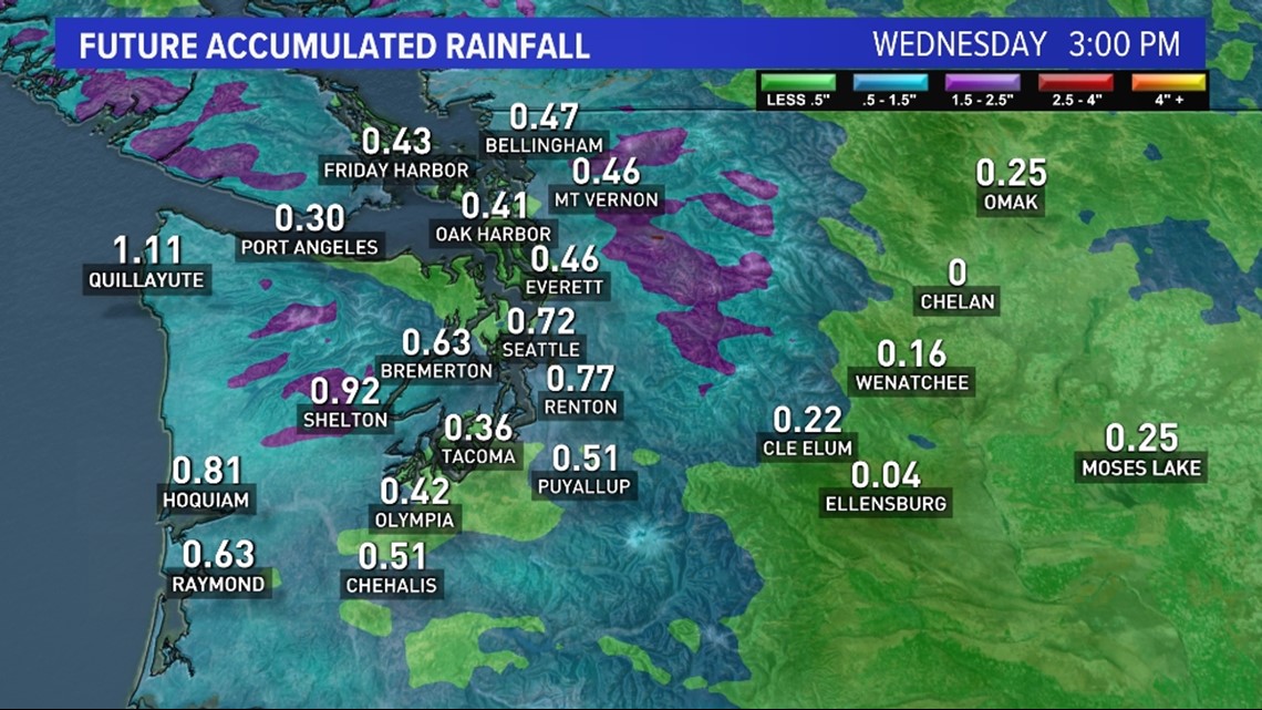
The Puget Sound lowlands can expect around 0.25 inches of rain with some of the lowlands pick up closer to 0.50 inches. Higher totals are forecast for the Washington coast and the Cascade foothills where up to 0.75 inches is expected.
This rainfall is expected to be beneficial and flooding is not a major concern.
Snow levels initially start out high early Tuesday around 5,000 feet, falling down to 3,500 feet by the end of the day. Passes will see light accumulations that could create minor travel impacts for the holidays.
Stevens Pass is expected to see 4-10 inches of snow and Snoqualmie Pass could see a couple slushy inches.
Rain accumulation forecast

Snow accumulation forecast