
SEATTLE — The active weather pattern continues with another, stronger storm system moving into western Washington today.
This strong low pressure system is expected to bring higher than normal tides, heavy rains, exacerbating flooding concerns and increasing the risk for mud and landslides as the soils are saturated. The saturated soils will also increase the risk for potentially widespread power outages as trees could give way to the high wind gusts over the next few nights.
Wind forecast
Widespread wind gusts of 30 to 50 mph are expected through Tuesday for all of western Washington, including all of Puget Sound. Higher wind gusts up to 60 mph are possible for Central and South Sound, including in Seattle. A few wind gusts could approach 70 to 80 mph near the Washington coast.
A High Wind Warning is in effect until Tuesday at 10 p.m. for the Washington coast. A High Wind Warning is in effect until Wednesday at 1 a.m. for the central and south Puget Sound, southwest interior, Admiralty Inlet, Hood Canal and the Strait of Juan de Fuca. Sustained winds are expected to be between 30 and 40 mph with gusts approaching 60 mph.
A Wind Advisory is in effect until Wednesday at 1 a.m. for the San Juan Islands, the northwest interior and areas north of Seattle.
The winds will continue throughout the majority of Tuesday so this will be a prolonged, widespread wind event. The strongest winds are expected to arrive Tuesday afternoon and evening.
With the strong, long-duration winds, paired with the saturated soils, trees will be susceptible to falling, leading to power outages and potential damage to property.
Make sure to be prepared for power outages. Charge the electronic devices, and make sure you have candles and flashlights ready. Also, be cautious if you have large trees near your home. It's probably a good time to take down or secure the Christmas decorations before the winds arrive.
Rain forecast
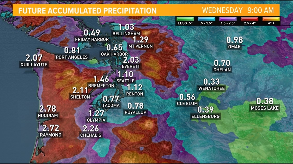
This system will also bring another round of moderate to heavy rain at times Tuesday and into Wednesday morning.
An additional widespread 1 inch is expected for Puget Sound with amounts of 2 inches near the coast and near the foothills. Isolated 3-inch amounts cannot be ruled out for some areas.
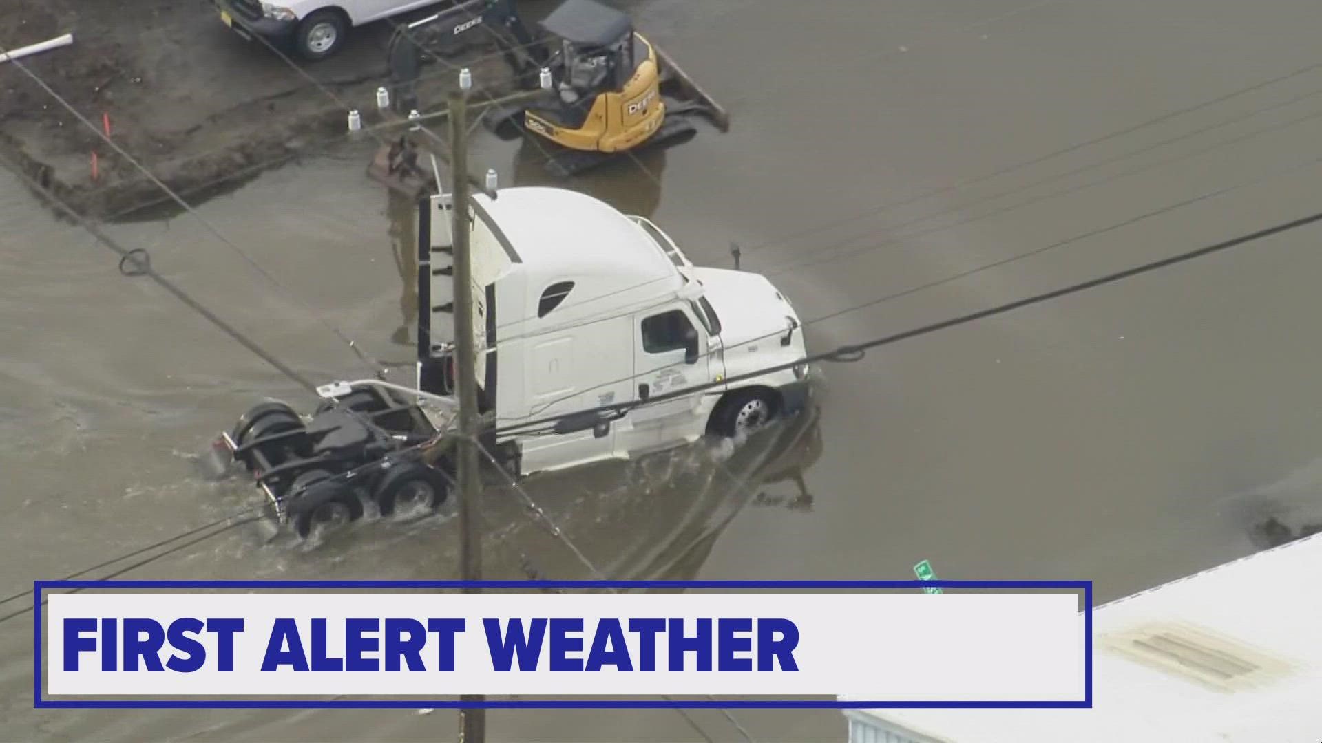
While these amounts aren't unusually high, with the saturated soils, it's possible localized flooding occurs in urban areas, including some minor street flooding. Please be cautious on the roads and never cross a road covered by water.
Rain accumulation forecast through Wednesday morning

The additional rain will only add to the unstable, saturated soils and could lead to some mud/landslides in the hillier neighborhoods and the foothills. If a home is in a vulnerable location, please be aware of the signs of these slides. Read about landslide preparedness and warning signs.
Mountain forecast
Snow levels drop Tuesday night back below pass level with 6-12 inches of snow expected above 2,500 feet. The snow will be driven by 65-mph winds, which could create whiteout conditions at times.
A Winter Weather Advisory is in effect for the Cascades until Wednesday at 10 a.m.
Flood Warnings
Coastal flooding impacted areas around Puget Sound with many low-lying areas experiencing saltwater inundation as the tide peaked Tuesday morning. The flooding was a combination of astronomically high tides, wind-driven piling up of water, lower atmospheric pressure, plus the continued increase in the sea level due to climate change.
As of Tuesday at 10:20 a.m., the National Weather Service has issued warnings for the following rivers:
- Cowlitz River at Randle: Minor flooding forecast
- Skokomish River at Potlach: Moderate flooding is occurring and forecast
A Flood Watch remains in effect through Wednesday morning for most of western Washington.
A Coastal Flood Warning is in effect Tuesday until 10 p.m. for the Washington coast with significant coastal flooding expected. High tide anomalies of 1 to 2 feet are expected.
A Coastal Flood Advisory will be in effect Wednesday from 7 a.m. until 1 p.m. for the Puget Sound, western Whatcom and Skagit counties, the San Juan Islands and the eastern Strait of Juan de Fuca.