
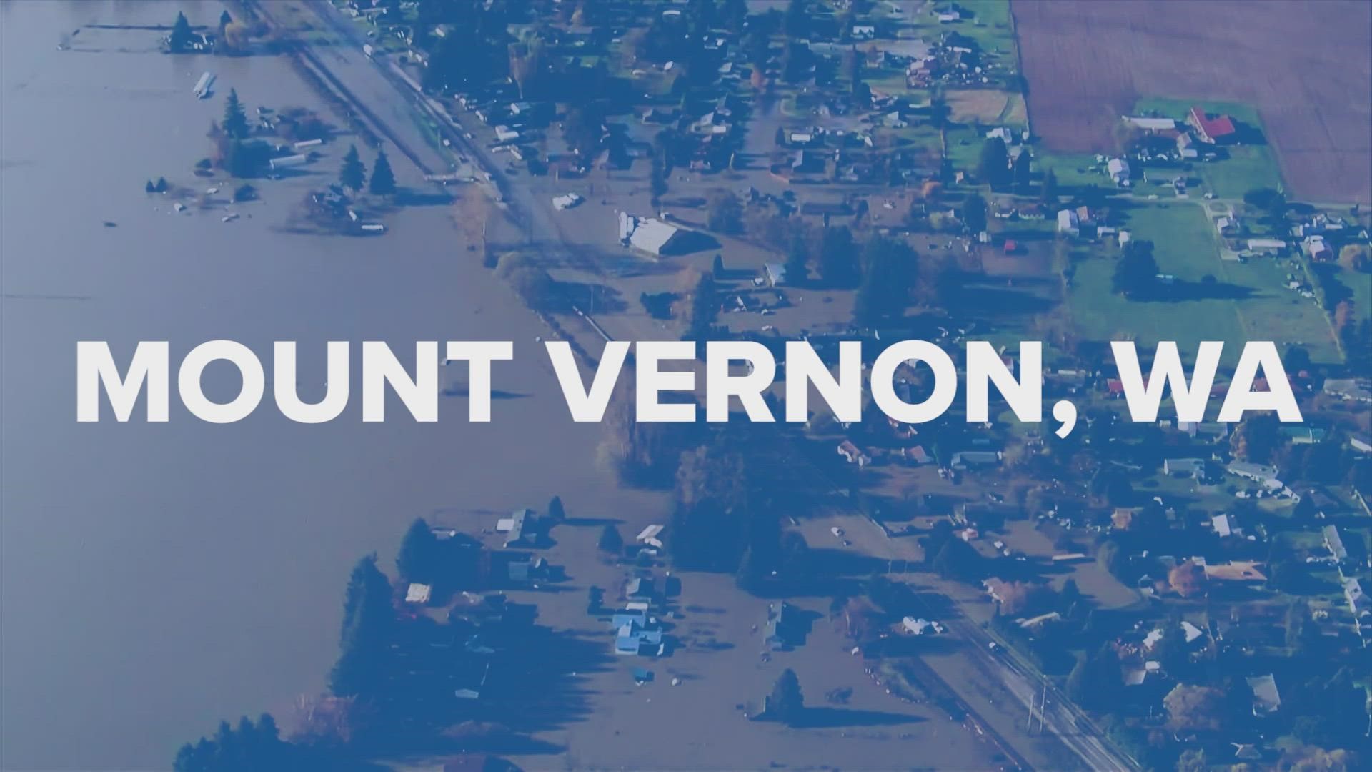
MOUNT VERNON, Wash. — The heavy rain over the past few days caused near-record flooding along the Skagit River near Mount Vernon.
The Skagit River's crest was 36.79 feet on Nov. 16 at approximately 8:30 a.m. The highest crest ever recorded was 37.37 feet on Nov. 25, 1990, according to data from the National Weather Service (NWS).
The crest along the Skagit River near Mount Vernon is now the fifth highest in recorded history.
Up in Ferndale, the Nooksack River crested at 23.76 feet on Nov. 16 around 7:40 a.m., according to data from the NWS. The record crest along the Nooksack in that area is 31.23 feet, recorded on Feb. 10, 1951.
The flooding seen along the Nooksack didn't break into the top five, but it is the highest crest in the past several years. In 2020, the river crested at 20.95 feet on Feb. 2.
The Samish River near Burlington crested at 13.9 feet on Nov. 15. There is no historic data available for the river in that area.
The flooding seen over the past few days in Whatcom and Skagit counties prompted evacuations and forced schools to close.
On Sunday, Nov. 14, Bellingham Airport recorded the fifth wettest day in history when 2.78 inches of rain fell, according to KING 5 Meteorologist Rich Marriott. Rainfall the next day broke the daily record, setting an all-time, two-day rainfall record for Bellingham at 4.67 inches.
The rainfall occurred during the second atmospheric river in the past several days.
An atmospheric river is a long, narrow region in the atmosphere, like a river in the sky, that brings water vapor from the tropics.