SEATTLE — Editor's note: The above video on the USGS adding more lahar detection sites at Mount Rainier National Park originally aired June 8, 2021.
SEATTLE - Western Washington is virtually surrounded on its eastern flank by volcanoes, a natural feature that is perhaps as wondrous as it can be destructive.
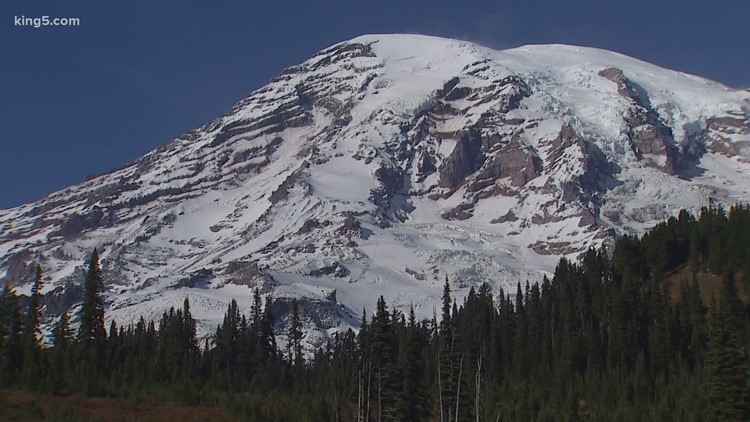
Mount Rainier, Glacier Peak, Mount Baker and Black Buttes are the three most northern of these volcanoes, reminding us how devastating eruptions and lava have shaped the land we call home.
While they may seem asleep under a cap of snow today, they can still cause a certain potentially damaging phenomenon to occur. These are called lahars.
What is a lahar?
Derived from an Indonesian term, a lahar is a hot or cold mixture of water and rock fragments that run down the slopes of a volcano, according to the U.S. Geological Survey (USGS).
These lahars then enter a river valley most often on or near a stratovolcano, which is the most common type of volcano, characterized by a conical shape at the top. Mount Rainier, Mount Baker and Mount Saint Helens are all stratovolcanoes.
These lahars usually start off small, but they grow as they move downslope, picking up anything in their path, often achieving a size 10 times that of their original flow.
The USGS says moving lahars look like a “roiling slurry of wet concrete.” The size, speed and amount of material being carried in the flow can change in an instant. In steep areas, the USGS said there have been lahars that have exceeded speeds of 120 miles per hour.
As the lahar moves further and further away from the volcano and closer to the base, it begins to decelerate and lose some of the material it’s collected on its way down.
What causes a lahar?
While eruptions can cause lahars, the phenomenon doesn’t need an eruption to get going. If an eruption triggers a lahar it is usually because it melts down snow and ice or ejects water from a crater lake at or near its peak.
Eruptions can also create lahars through pyroclastic flows, which are high-density mixes of hot lava, pumice, ash and volcanic gas. These eat up rock debris and melt snow and ice as they move downslope.
Perhaps most often, though, lahars are caused when there is a long period of consistent rainfall or a high-volume rainfall event. These can happen during or after an eruption with rainwater eroding and picking up sediment. This then forms a slurry, which is made even more possible if vegetation hasn’t grown back following a recent eruption.
Additionally, the USGS said flows can be caused by lakes breaking out or overflowing. This can happen if a landslide or even a pyroclastic flow forms a natural dam across a river or stream.
The largest lahars, according to USGS, have begun as landslides formed by hot, wet rock on very steep parts of the volcano.
What are the effects of lahars?
Large lahars can destroy, bury and carry away pretty much anything in their paths. Whether it’s a building, a vehicle or a valuable crop, lahars can cause significant damage.
Lahars also pose a threat to important infrastructures like bridges and roads. This kind of damage could not only pose a risk to travelers but can also put an entire community in danger by blocking their escape from other volcanic hazards.
Also, lahars that cause or are caused by natural dams can create chronic flooding in areas that aren’t necessarily prone to floods.
In recent years, a lahar came through Mount Rainier National Park in 2006 that rerouted the Kautz Creek, which had already been reshaped in 1947 by a similar debris flow.
Can you prepare for a lahar?
The USGS has established a comprehensive lahar and volcanic monitoring system at Mount Rainier. Scientists have been working especially hard to develop a warning system for lahars specifically with at least a dozen detection inside the Mount Rainier National Park.
In 2020, the USGS showed KING 5 how the detection systems work, explaining how they use audio sensors to track the direction and speed of a lahar.
These sensors detect pressure changes in the air caused by lahars and can alert specialists to any major flows in the area.
In June last year, the USGS proposed expanding this system with 17 new detection sites.
As far as preparing for a lahar, evacuation drills can help residents respond to a lahar quickly and efficiently.
Students in Pierce County are participating in what the city of Puyallup is calling the biggest lahar drill in the nation on April 29. Students will walk their evacuation routes in preparation for a possible Mount Rainier eruption.