
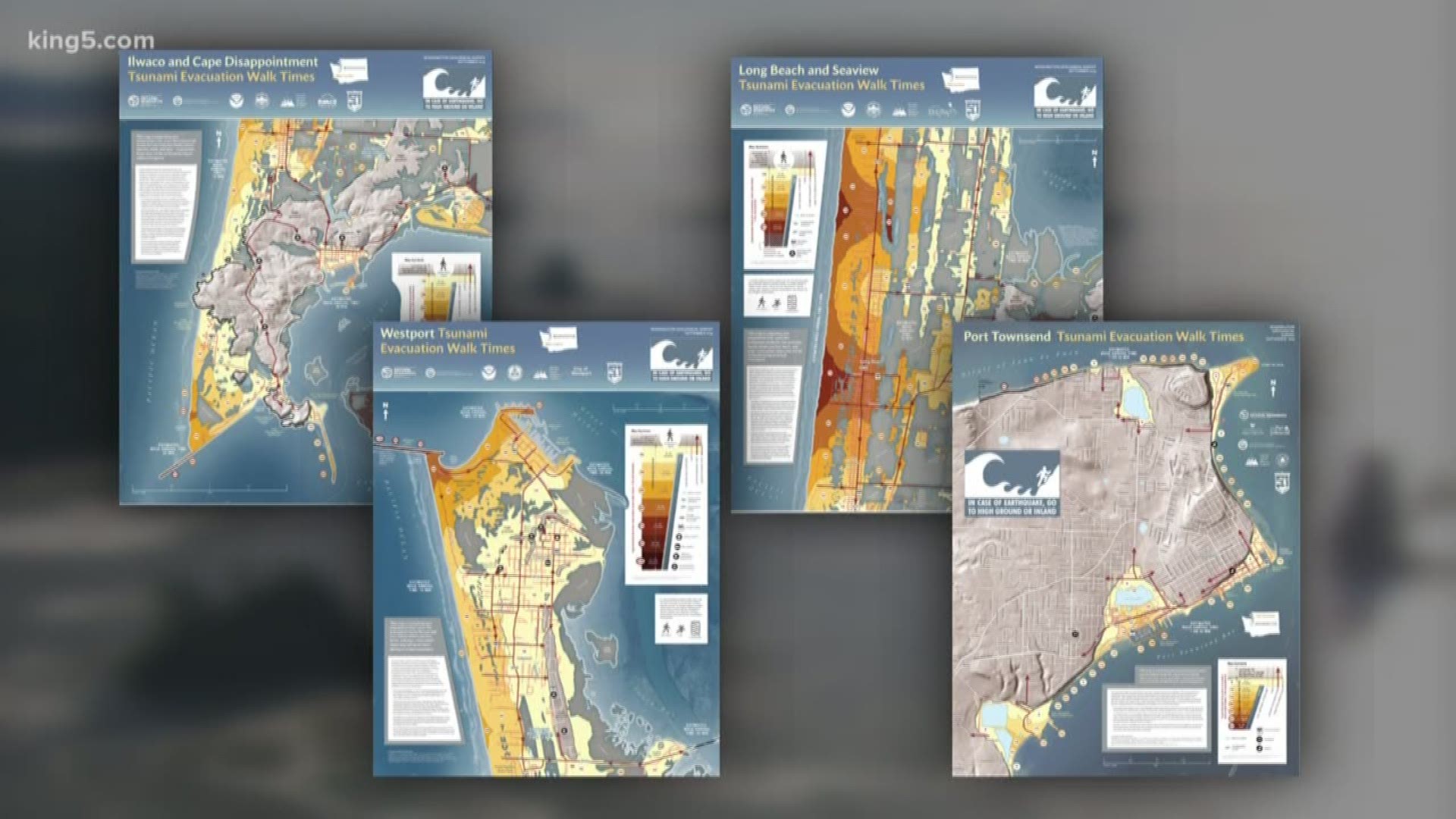
OLYMPIA, Wash. — The Washington State Department of Natural Resources (DNR) has published new maps to help residents in four coastal areas safely evacuate in the event of a tsunami.
The new maps, produced by DNR's Washington Geological Survey, shows the times it would take to evacuate on foot from the tsunami zones caused by a Cascadia Subduction Zone earthquake.
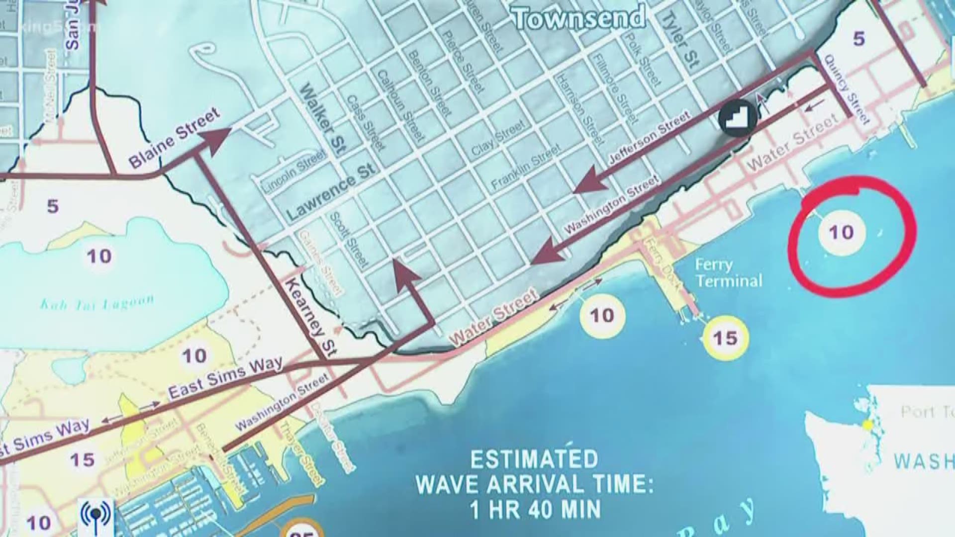
The maps are colored to indicate how many minutes it would take to walk to safety from the inundation zone in Port Townsend, Long Beach and Seaview, Ilwaco, and Westport, assuming a slow walking pace of 2.46 miles per hour.
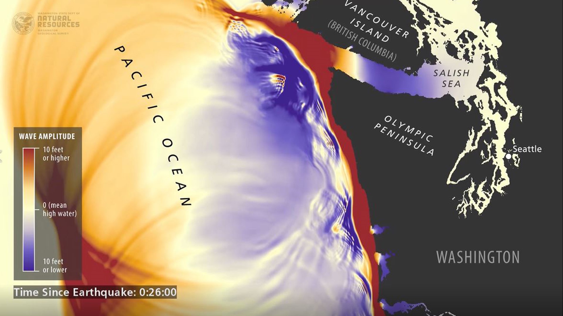
Waves from a Cascadia earthquake-induced tsunami could reach coastal areas like Long Beach or Westport in as soon as 15 minutes after the earthquake starts.
Effective walk times differ for communities based on their topography. For example, people at Cape Disappointment can safely walk to higher ground in as little as 15 minutes, while the walk to safety from Long Beach can take as long as 75 minutes, according to DNR.
In April, the DNR released tsunami evacuation maps for Port Angeles, Bellingham, Anacortes, and Aberdeen, Hoquiam, and Cosmopolis.
The geologic record shows the Cascadia Subduction Zone – the offshore area where the Juan de Fuca tectonic plate is pulled under the larger North American plate – produces megathrust quakes about every 300 to 600 years.
These maps are based on a magnitude 9 Cascadia earthquake. The maps can also be used for smaller earthquake events as well.
“We’ve seen around the world how devastating tsunamis are for coastal communities,” said Commissioner of Public Lands Hilary Franz. “In the event of a tsunami, nothing is more important than knowing where to go to be safe and how long it will take to get there. That is why the Department of Natural Resources’ geologists are doing the vital work of making this life-saving information easily accessible for everyone who lives, works or plays along Washington’s coast.”
Some tsunami warning signs can include:
- Hearing a tsunami warning siren or receive a tsunami alert.
- Feeling a strong earthquake near the ocean or a large lake. A strong earthquake is one that knocks people down, damages buildings, or lasts for longer than 20 seconds.
- Seeing a very large wave approaching.
- Seeing coastal waters recede. As the tsunami approaches, sometimes sea level will drop rapidly as the wave gets taller.
- An unusually rapid rise in sea level. Some tsunamis will have a surge in front of them as they approach land. These surges can be damaging and dangerous.
- A landslide that falls or slides into the ocean, a large lake, or a river.
If you notice any of these signs, begin evacuating immediately.
DNR also has additional evacuation maps, preparedness plans, and other resources. Click here to learn more.
Be sure to connect with your community to learn how to best be ready for the worst. Join the KING 5 Disaster Preparedness Facebook group to get ideas and tips on emergency preparedness.
See the latest on our Disaster Preparedness coverage here. You can also download the KING 5 news app for the latest on weather and disaster-related news. On the app, you can subscribe to get alerts on our disaster coverage.