

SEATTLE — Parts of the Puget Sound lowlands saw some relief from the arctic cold and snow over the weekend, but that relief may be short-lived. Cooler air is forecast to move into parts of western Washington again this week, bringing with it another chance of lowland snow.
The National Weather Service (NWS) said parts of western Whatcom County could see “significant” snow accumulation by Thursday morning with up to 6 inches possible, and the Cascade mountains could see between 1-2 feet of new snow.
Snow accumulation is expected to be generally light for the lowlands south of Whatcom County. Parts of the east Puget Sound lowlands near the foothill could get 1-2 inches of new snow.
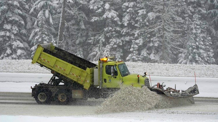
Snow in the mountains could make travel across the passes difficult or even impossible if roadways are closed due to adverse conditions.
Below is a forecast timeline of what to expect for the rest of the week:
Wednesday
We will see a break in the precipitation until Wednesday afternoon. Cold air from the Fraser River Canyon dropped temperatures for parts of the north Sound into the upper teens and low 20s this morning with single-digit wind chills.
Highs on Wednesday will be in the mid to upper 30s.
A strong warm front will spread increasing rain and snow into western Washington Wednesday afternoon. The NWS said widespread lowland snow is possible Wednesday afternoon through early Thursday morning.
Snow accumulation is expected to be generally light for the lowlands south of Whatcom County. However, the NWS said the weather system could bring major travel impacts to the Cascade passes, Whatcom County, and parts of the Olympic peninsula.
Increasing rain or snow will move into Olympia around noon. It may start as rain but should turn to wet snow as the precipitation becomes heavier this evening. Rain or snow should be up and down the Sound by 5 p.m., and snow will spread into Whatcom County after about 5 p.m.
Precipitation is expected to start as rain or snow, except for areas north of Everett which will see all snow, with 1-3 inches of wet slushy snow before turning to rain by midnight. Areas farther away from Puget Sound will see larger amounts, especially on the Kitsap Peninsula near the Hood Canal and areas near the Cascade foothills.
Snowfall is expected to last longer and could be significantly more in areas of Whatcom County. The NWS issued a Winter Storm Warning for western Whatcom County from 4 p.m. Wednesday until 4 a.m. Thursday. Between 2-6 inches of snow is possible from Wednesday night into Thursday morning, with a brief period of freezing rain Thursday morning.
The NWS issued a Winter Weather Advisory for San Juan County and the east Puget Sound lowlands from Snohomish to Pierce counties from 4 p.m. Wednesday until 2 a.m. Up to 3 inches of snow is possible with a brief period of light freezing rain Wednesday evening or early Thursday morning. An advisory is also in effect for that same time for western Skagit County and areas near Hood Canal and the Strait of Juan De Fuca.
The snow should turn to rain below 1,000 feet by midnight except in Whatcom County and the mountains, where the transition to rain isn’t expected to happen until before daybreak Thursday.
A Winter Storm Warning was also issued for the Cascades of Whatcom, Skagit, Snohomish, King, Pierce and Lewis counties above 1,500 feet from 1 p.m. Wednesday until noon Thursday. The NWS said the Cascades could see total snow accumulations of 12-28 inches, with winds gusting as high as 40 mph.
The Winter Storm Warning includes the Mount Baker and Crystal Mountain ski areas, along with Snoqualmie and Stevens passes. The NWS said travel could be difficult, and heavy snow could close the mountain passes.
There is a “considerable” avalanche danger for the Washington Cascades Wednesday, according to the Northwest Avalanche Center. The avalanche danger is expected to increase significantly Wednesday night into Thursday due to more snowfall and rising temperatures. Highway pass closures are possible Wednesday night and Thursday due to road conditions and avalanche danger.
Thursday
Thursday will be wet early as a weather front drops southeast through the Sound during the morning. The front is expected to stall over the central Sound in the morning, bringing off-and-on showers north of Seattle and steady rain south of Seattle during the afternoon.
The front will lift northward again Thursday night for another round of steady rain across western Washington.
Around 1-2 feet of new snow is expected to fall in the Washington Cascades by Thursday morning. Snow levels may reach 4,000 to 5,000 feet in the mountains with a mix of rain, freezing rain, and snow Thursday.
The avalanche danger will increase significantly into Thursday due to more snowfall and rising temperatures. Some highway pass closures are possible Thursday due to road conditions and avalanche danger.
The rain and melting snow will bring the threat of flooding to western Washington.
Temperatures will rise Thursday, with some areas hitting 50 degrees.
Friday into the weekend
Rain showers on Friday are forecast to end Saturday. The weekend will be mostly dry with partly to mostly sunny skies.
Highs will be in the low to mid-40s.
