
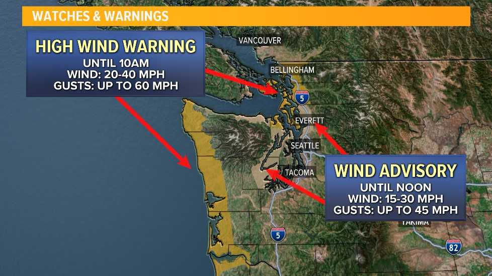
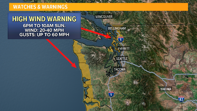
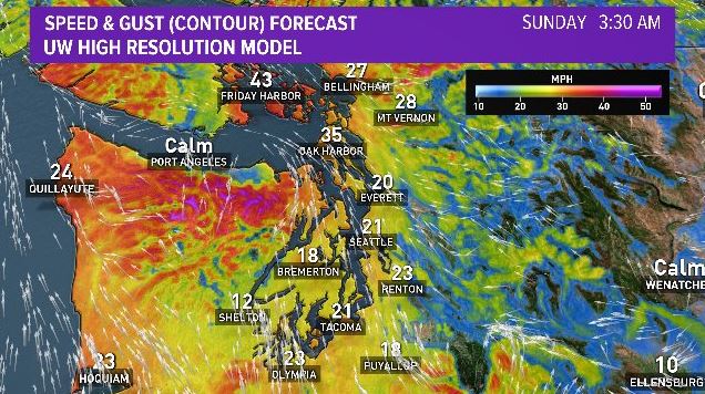
Batten down the hatches. The National Weather Service issued high-wind warnings for portions of Western Washington through midday Sunday. The windiest locations will be along the coast, San Juan Islands, Admiralty Inlet, and western Skagit and Whatcom Counties.
Earlier today, the wind caused a traffic problem on SR 542. The Washington State Department of Transportation reported downed trees blocking the right lane of eastbound SR 542 at Y road.
Some minor power outages are reported in the Northwest Interior, fewer than 4,000 customers at last count.
You can check outages with Puget Sound Energy...
The coast and parts of the Northwest Interior are under High Wind Warnings, meaning sustained wind speeds between 20-40 mph with gusts up to 60 mph are imminent or highly likely through lunchtime Sunday.
The Everett area, as well as Hood Canal and the eastern Strait of Juan de Fuca, are under advisories (15-30 mph with gusts up to 45 mph).
A series of Pacific storms will continue to hit our area this upcoming week.
Heavy snow is also in the forecast for the Cascades, with the snow level dropping to around 2,000 feet.
Yup, it’s still winter, folks.
Behind this cold front, the wind will subside some, and the steady rain tapers to showers. It will be a less active afternoon.
It's a good idea now to plan ahead. There could be localized power outages and downed tree limbs this weekend that could leave some of you in the dark. The good news is that this wind event won’t last all that long.
