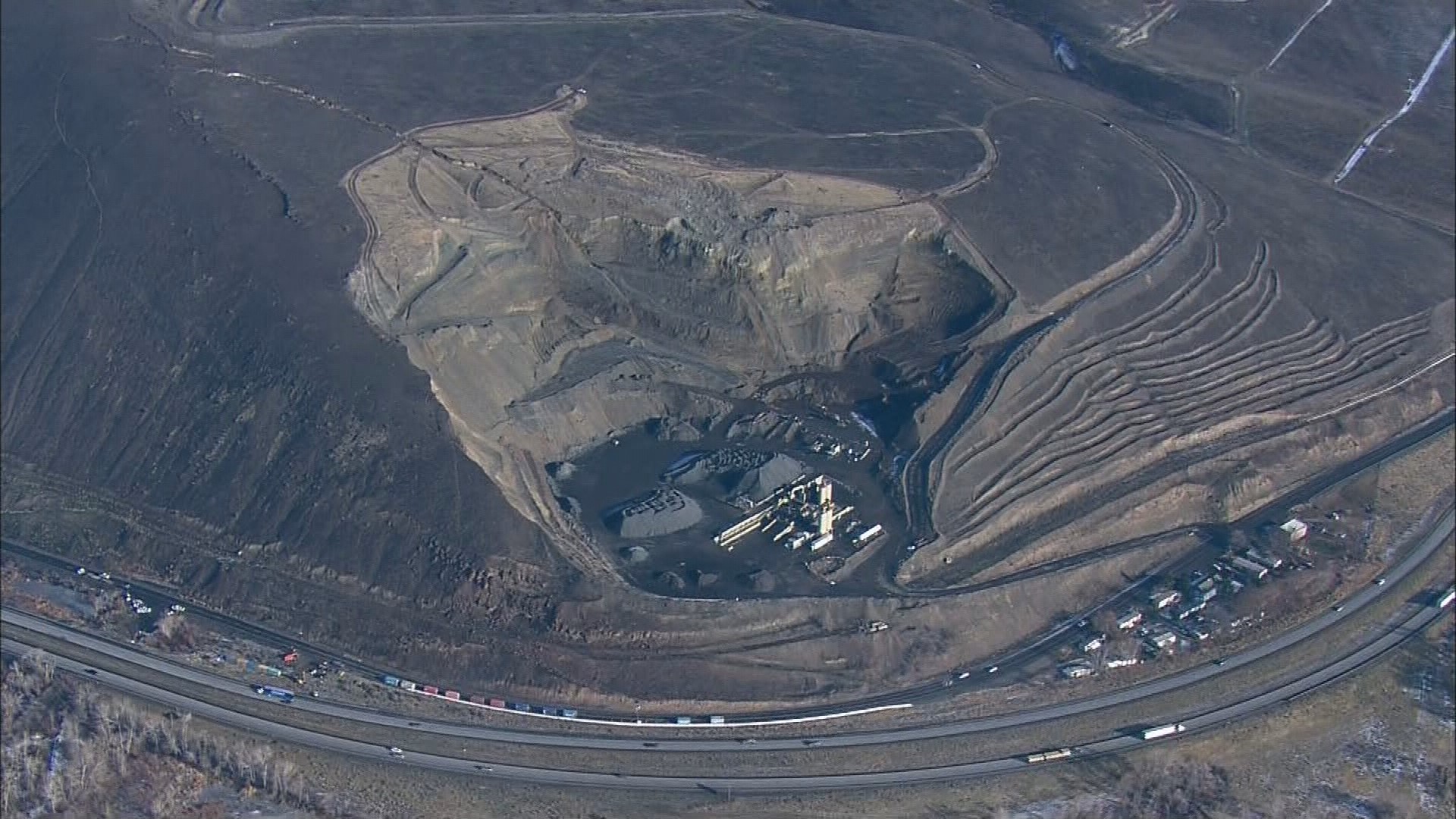
The Pacific Northwest Seismic Network detected seismic activity this week near a slow-moving landslide near Rattlesnake Ridge in Yakima County.
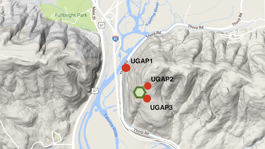
PNSN installed three temporary portable seismic stations near the landslide on Tuesday and released their initial findings Thursday.
The network hopes to study the signals to understand what the landslide might do in the future.
The crack on the ridge emerged in October and has widened since, forcing evacuations for nearby homeowners. The landslide is moving at a rate of 1.3 feet per week and is accelerating, according to state geologist Dave Norman.
Sesimograms and spectrograms showed tiny blips of high-frequency near the UGAP2 and UGAP3 stations, which are located north-northwest and east of the slide area, respectively. They are the two closest stations to the landslide.
“We speculate that based on their short durations and impulsive first arrivals, they are either due to brittle slip/cracking or free-fall impacts of individual rocks but…not related to large rockfalls,” the network wrote in a blog post.
Seismograms also picked up frequencies from trains on nearby rail lines and several low-frequency signals, which the network says it does not yet understand.
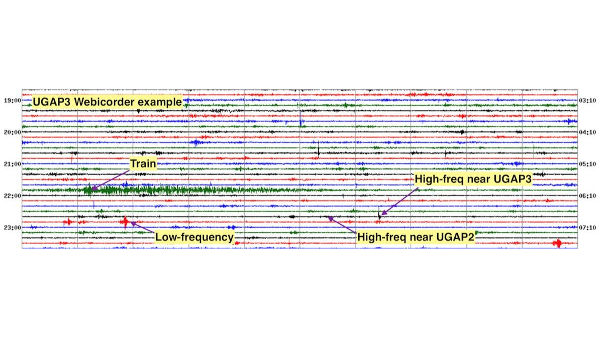
“At this point we are not absolutely sure of these interpretations but based on lots of experience we think they are reasonable,” PNSN wrote.